State Library of Queensland has an extensive collection of historical maps of Queensland, some of which have been digitised and can be viewed online.
This Brisbane real estate map from 1882 is advertising 743 allotments of land for sale at Thorrold Town (now Wooloowin).
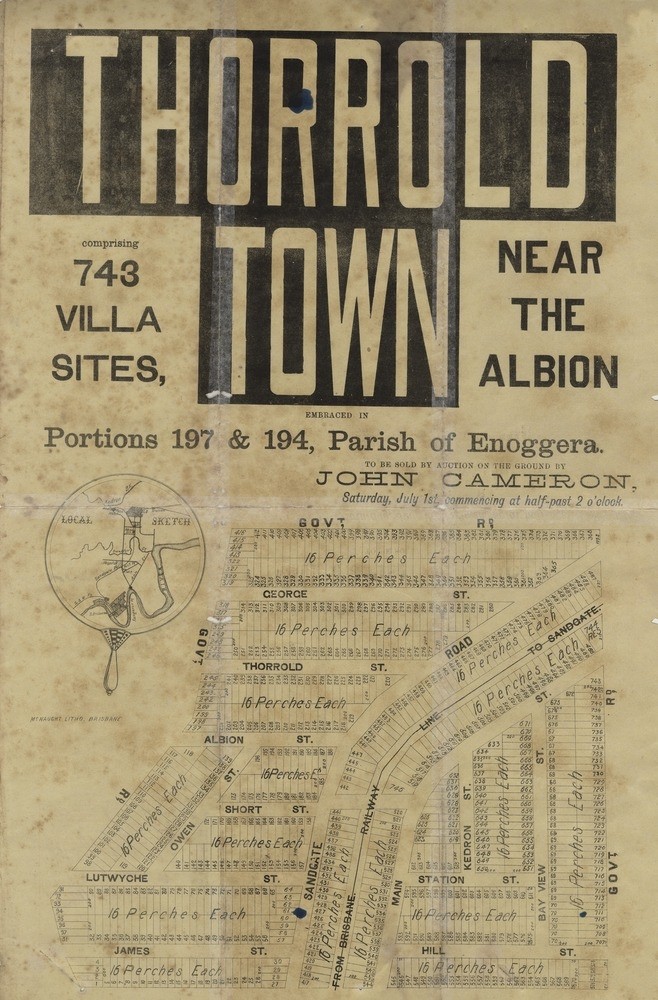
Thorrold Town Estate, , 1882. John Oxley Library, State Library of QueenslandThe allotments for sale were situated along George Street (later renamed Rawson Street); Thorrold Street; Albion Street (later renamed Price Street); Owen Street, Short Street (later renamed Ashbolt Street); Lutwyche Street (later renamed McIntyre Street); James Street (later renamed Wride Street); Sandgate Road (later renamed Dickson Street); Main Street (later renamed Adamson Street); Kedron Street; Station Street (later renamed Hamley Street); Hill Street (later renamed Stopford Street); Bay View Street (later renamed View Street) plus three unnamed Government roads (later named Kent Road, Rose Street and Bonney Avenue)
Brisbane newspapers featured articles and advertisements publicising the sale...
"A very important auction sale of land will take place near Albion,...the auctioneer being Mr John Cameron. The land is known as Thorrold Town, and includes no fewer than 743 villa sites, situated on either side of the Sandgate railway, near the Lutwyche station, and having frontages to about sixteen roads and streets, including the old Sandgate road, none of them less than a chain wide. For the guidance of intending purchases the auctioneer has issued very complete maps (a large and small one) of the ground to be offered, so that although the lots are so numerous there will be no difficulty in "spotting" any particular one. The terms appears to have been settled on liberal scale." (Brisbane Telegraph, June 28, 1882)
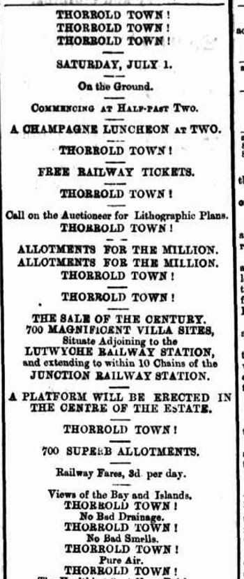
Advertisement from The Telegraph newspaper, June 23, 1882
A public auction was held at the site on the afternoon of July 1, 1882. The Brisbane Telegraph newspaper on July 3 published the following report –
"There was a good attendance at the sale of the Thorrold Estate...which took place on the ground on Saturday afternoon. A train left town shortly before 2 o'clock, with a large number of passengers, and on arrival at the ground were entertained at a first-class champagne luncheon provided by host Daly. The result of the sale was highly satisfactory to the vendor, and the very brisk competition on the part of bidders for the various allotments offered was a sufficient proof of the increasing value of the property in and suburban to the metropolis. The Thorrold Estate comprises 743 lots, of 16 perches each; and, of the lots disposed of, the prices realised were from 16 to 37, the highest bids being for those on the top of the hill facing the old Sandgate Road, and from which a good view could be obtained. The total number sold was 155, for £2,110, thus leaving 588, which will be disposed of at Mr J. Cameron's auction mart on Thursday next, when 100 lots will be submitted without reserve, the sale to commence at noon." (Brisbane Telegraph, July 3, 1882)
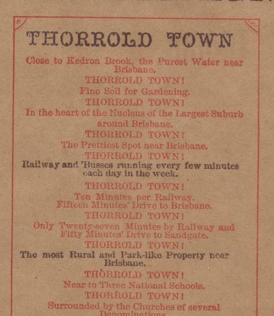
Reserve side of Thorrold Town map. John Oxley Library, State Library of Queensland
A higher resolution image of this map can be viewed through our One Search catalogue.
You can also browse a compendium of our previous maps of the week.
Further reading
Comments
Your email address will not be published.
We welcome relevant, respectful comments.