State Library of Queensland has an extensive collection of historical maps of Queensland, some of which have been digitised and can be viewed online.
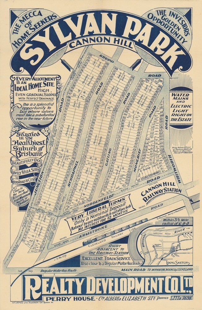
Sylvan Park Estate, Cannon Hill, Brisbane, 1926. John Oxley Library, State Library of Queensland
This real estate map from 1926 advertises 651 allotments of land for sale at the Sylvan Park Estate in the Brisbane suburb of Cannon Hill. The allotments were situated along Junction Road, Schrapnel Road, Gatling Road, Moncrief Road, Whitworth Road, Nordenfeldt Road and Krupp Road.
During the sale extensive publicity was published in Brisbane newspapers.
"It is within 3 1/2 miles of Brisbane G.P.O., close to Cannon Hill railway station (on the Cleveland Line), with an excellent train service, also handy to good bus service, and the Wynnum-Manly bitumen road, Water main, and electric light are on the Estate. It is a cool, picturesque, and healthy spot, with a marvellous future, and every block is a perfect home site." (Daily Mail, August 26, 1926)
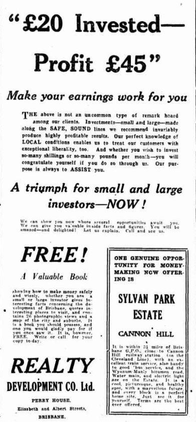
Advertisement, Daily Mail, Aug 13, 1926
A higher resolution image of this map can be viewed through our One Search catalogue.
Prints of this map are also available through the Library Shop.
You can browse a compendium of our previous maps of the week on our blog.
Myles Sinnamon - Project Coordinator, State Library of Queensland
Comments
Your email address will not be published.
We welcome relevant, respectful comments.