The Maps Collection housed in the John Oxley Library Reading Room at the State Library of Queensland contains many cartographic treasures including early Australian maps. An interesting catagory within the collection is military maps from WWII, including examples of 'escape' maps printed on silk.
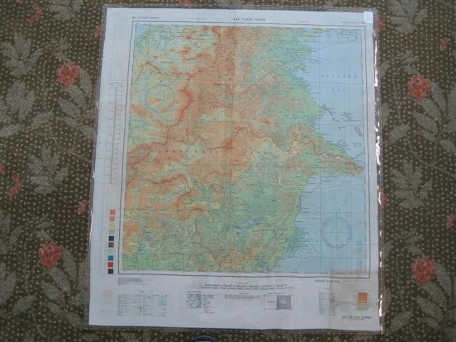
Christopher Clayton Hutton developed cloth maps for MI9 during World War II. Hutton was hired by the War Office to create the escape gear necessary for Britons to escape capture and was responsible for an enormous variety of escape aids including flying boots and uniforms that could be easily converted to look like civilian clothing and powerful torches concealed inside bicycle pumps for use by the French Resistance.
Although the famous Edinburgh map-making firm of John Bartholomew & Sons generously waived all royalties to its maps, for the privilege of helping the war effort, Hutton still needed a medium on to which he could print maps that were quiet to unfold, would not disintegrate when wet, and maintained their integrity when folded yet still be concealed in very small places. After many attempts to print on silk squares, he was about to give up when he thought of adding pectin, a form of wax, to the ink such that it did not run or wash out when put in water, or even sea water.
After this, the British produced hundreds of thousands of maps on thin cloth and tissue paper. Silk maps soon became ‘the escaper’s most important accessory’ and were issued especially to airmen so that they could sew them into their clothes or wear them around their neck as a scarf. A map like this could be concealed in a small place, a cigarette packet or the hollow heel of a flying boot, did not rustle suspiciously if the captive was searched and in the case of maps on cloth, could survive wear and tear and even immersion in water. The scheme was soon extended to cover those who had already been captured, although a certain amount of ingenuity was required to get the maps into the POW camps.The maps themselves were mainly small scale, covering large areas; many were copied from Bartholomew's traditional paper maps.
Information taken from: Mapping the World: an illustrated history of cartography by Ralph E. Ehrenberg 1937-
Comments
Your email address will not be published.
We welcome relevant, respectful comments.