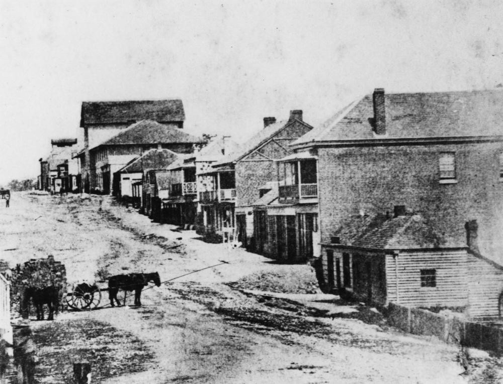
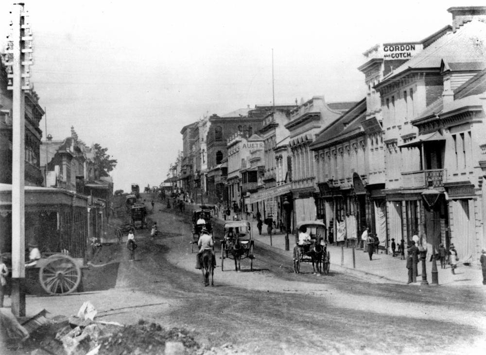
Early view of Queen Street, Brisbane, ca. 1859. State Library of Queensland. Negative number: 8298
Queen Street, Brisbane, as the city's main street, is at the centre of the network of streets that make up the central business district as well as the streets of South Brisbane, both in the street's name as well as its alignment and width.
Queen Street began as little more than a track leading from the main part of the early Moreton Bay Penal Colony, running northward, crossing the watercourse then known as Wheat Creek, with a deviation leading up to the Windmill.
With the opening up of the area to free settlement in 1842 and the consequential growth of Brisbane Town, there was a need to develop a more formal and usable system of streets. Surveyor Dixon had undertaken a survey of the streets of the town in early 1840, which essentially comprised a grid pattern of square blocks, ten chains (approximately 200 metres), with streets 66 feet (approximately 20 metres) wide. The position and direction of these streets were based upon the position and alignment of the existing Prisoners' Barracks and cut across the various tracks that had developed over the life of the settlement.
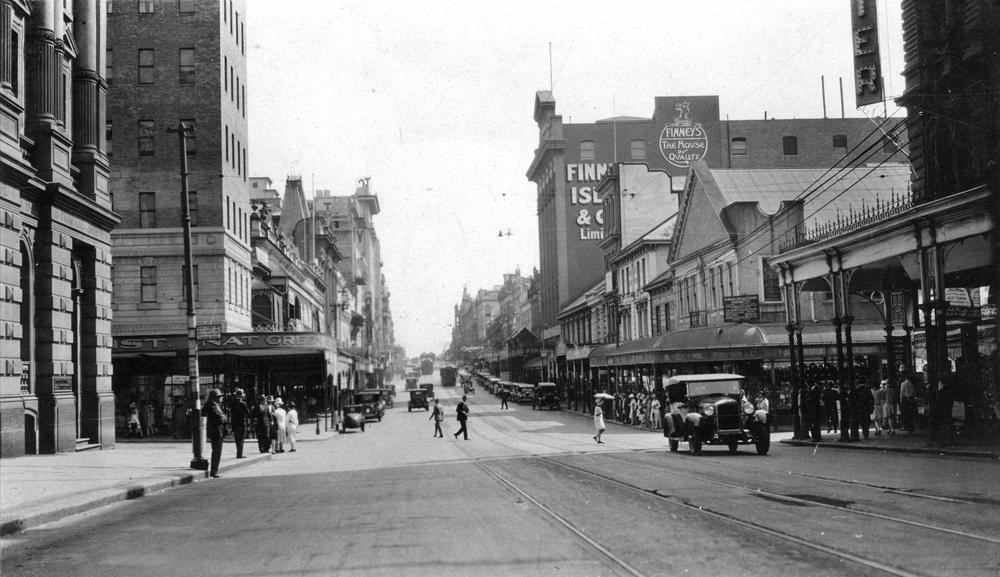
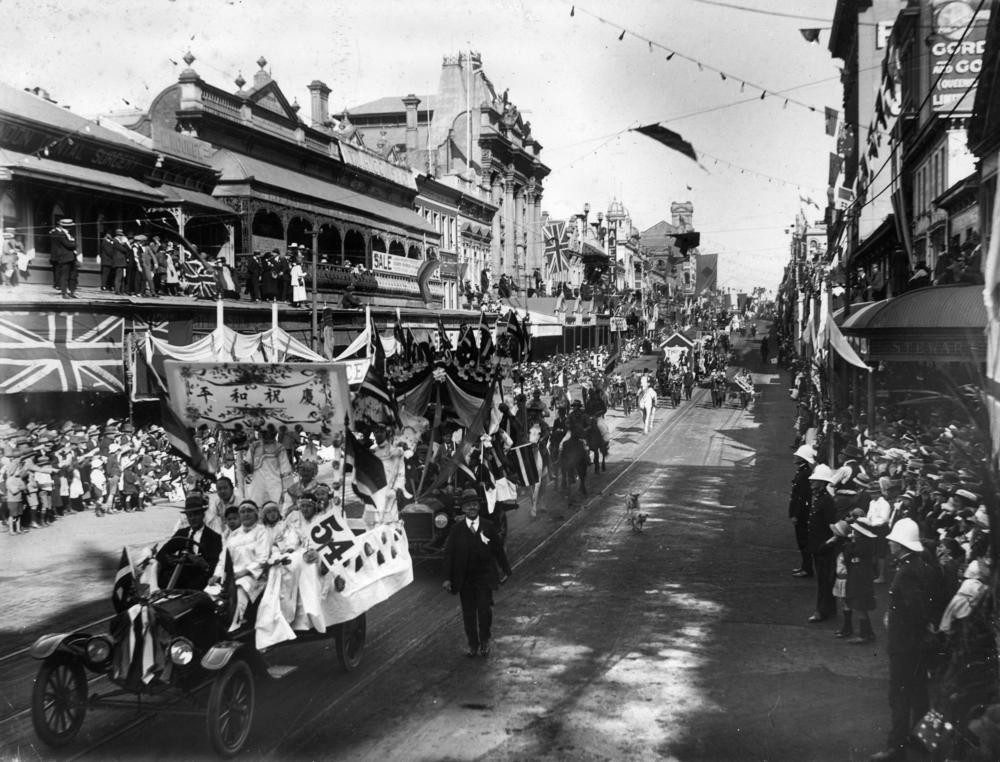
Queen Street, Brisbane, Queensland, ca. 1928. State Library of Queensland. Negative number: 204351
Subsequently, some changes were made to this initial layout. The square blocks were flattened into a rectangular grid with the streets being widened up to 1.4 chains (approximately 27 metres). However, Governor Gipps, when visiting in March 1842, was not greatly impressed with the settlement, seeing Brisbane Town as "simply an ordinary provincial settlement", which would have no need for grand avenues. So Gipps ordered the planned width of the streets back to 66 feet (approximately 20 metres), arguing that this would ensure that the buildings of each side of the streets could be kept out of the sun.
There was some later compromise with the main street, later to become Queen Street, having its western boundary moved to accommodate a width of 1.2 chains (approximately 24 metres), however, the other streets were to remain at the initially planned width of 66 feet (approximately 20 metres).
The names of the streets were also to follow a pattern. Those running in a north-easterly direction were named after queens - Ann, Adelaide, Elizabeth, Queen, Charlotte, Mary and Margaret. Those that ran in a north-westerly direction were named after kings, including William, George, Albert and Edward.
Across the river, in South Brisbane, the newly laid out streets were given names that would fit with or complement those in Brisbane Town's centre. To achieve this, the names of British government members or civil servants were used, with some examples as follows:
Herman Merivale - Permanent Under-Secretary of State for the Colonies, 1847-57
George Hope - Parliamentary Under-Secretary of State for War and Colonies under Lord Stanley
Lord Stanley - Secretary of State for War and Colonies in the Peel Government, subsequently Prime Minister.
Lord Melbourne - Prime Minister, 1837
Henry George Grey - Secretary of State for War and Colonies, 1846-53 in the Russell Government
Lord John Russell - Secretary of State for War and Colonies, Prime Minister as well as Foreign Secretary
Sir Robert Peel - Prime Minister
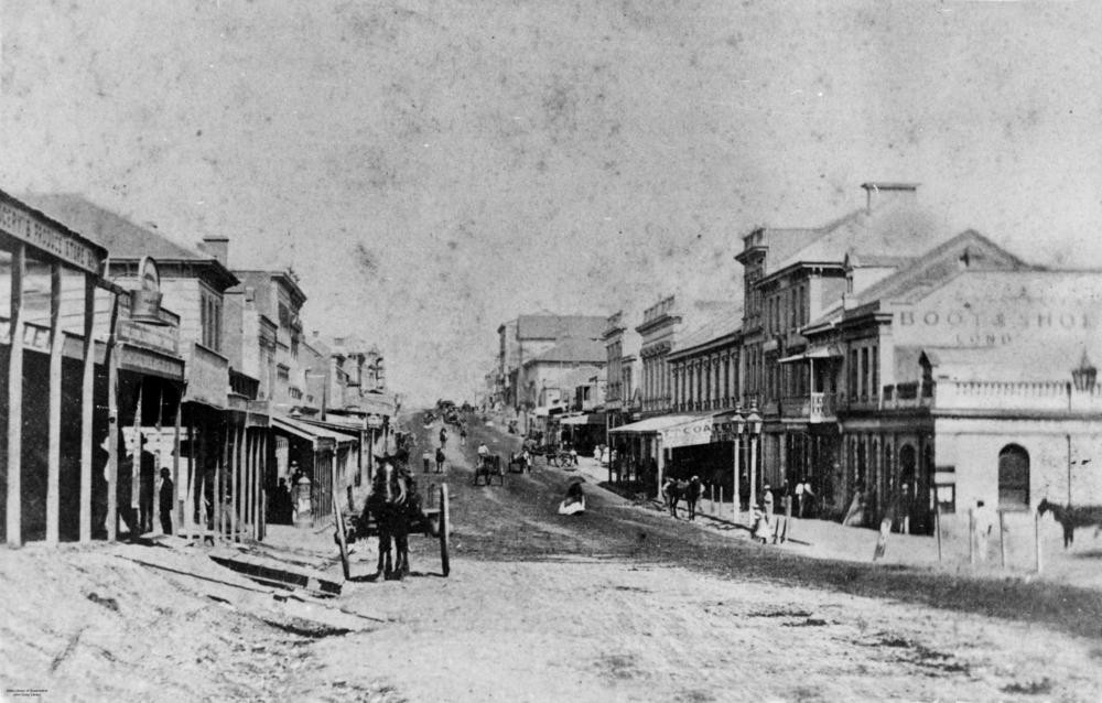
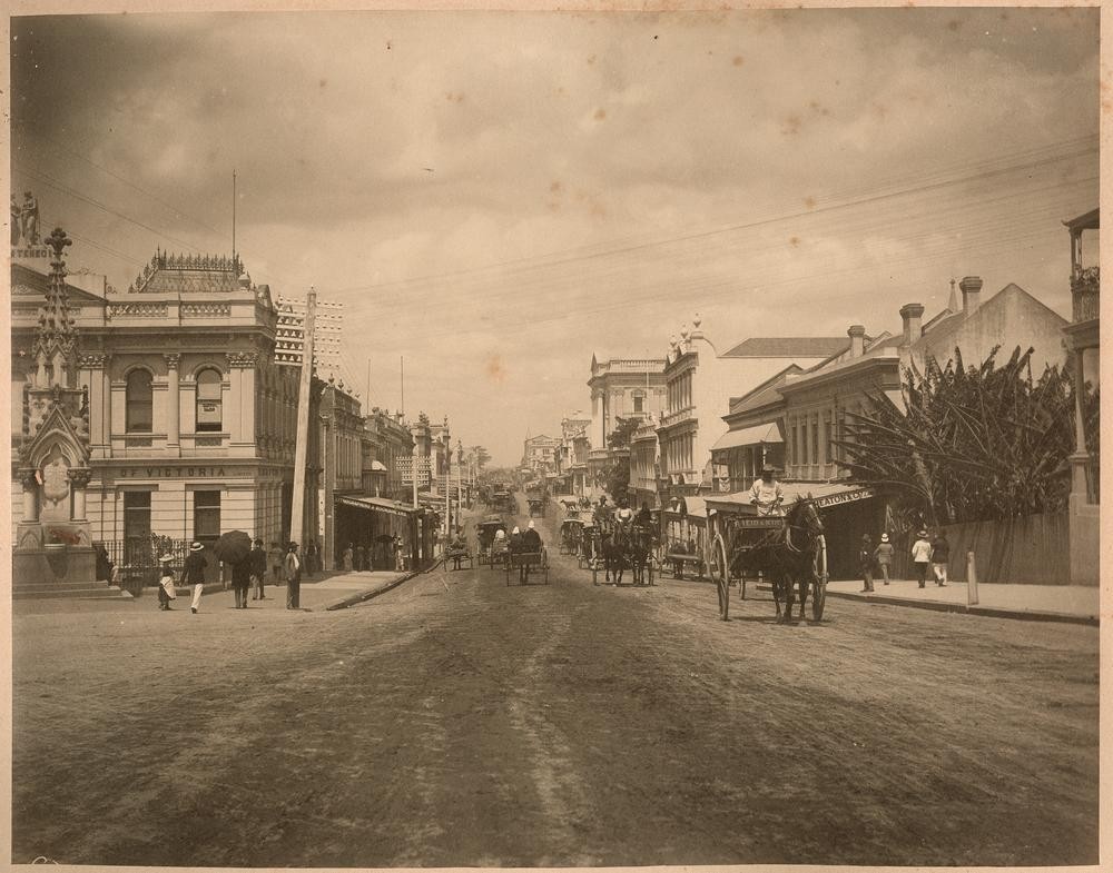
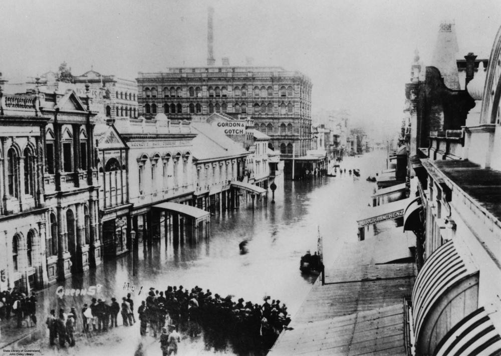
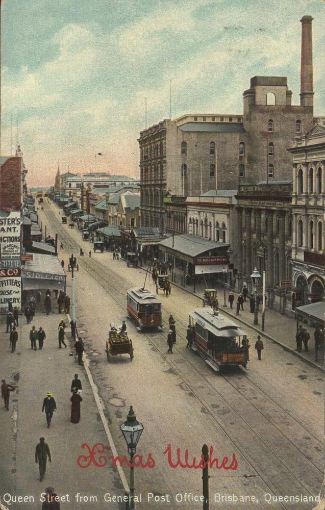
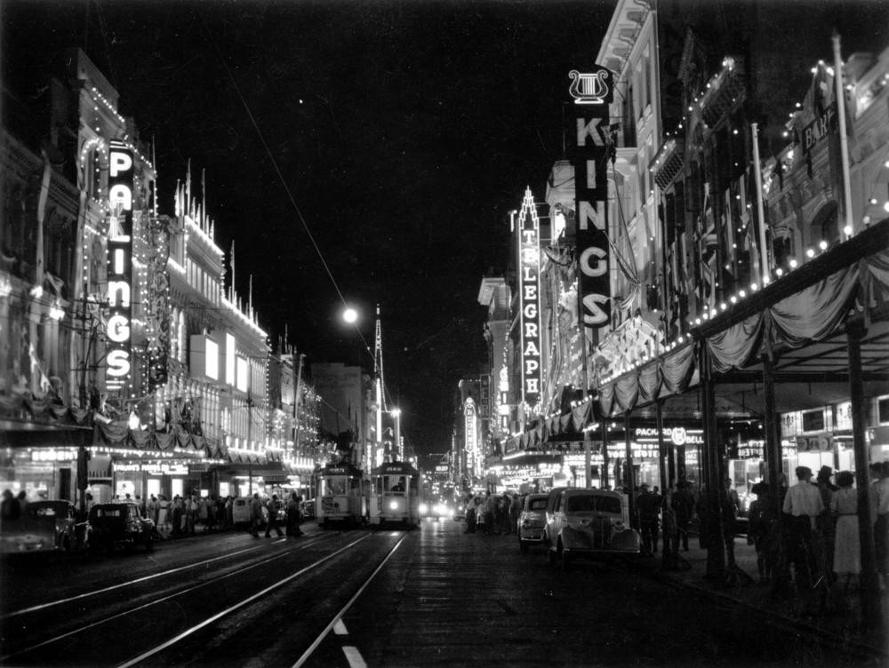
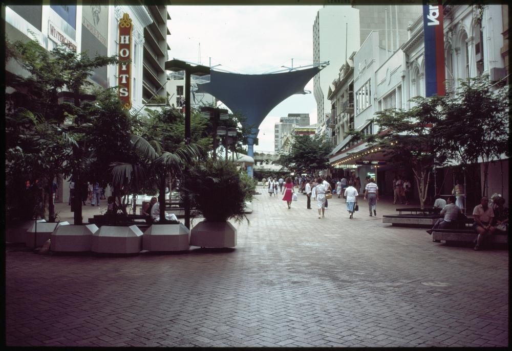
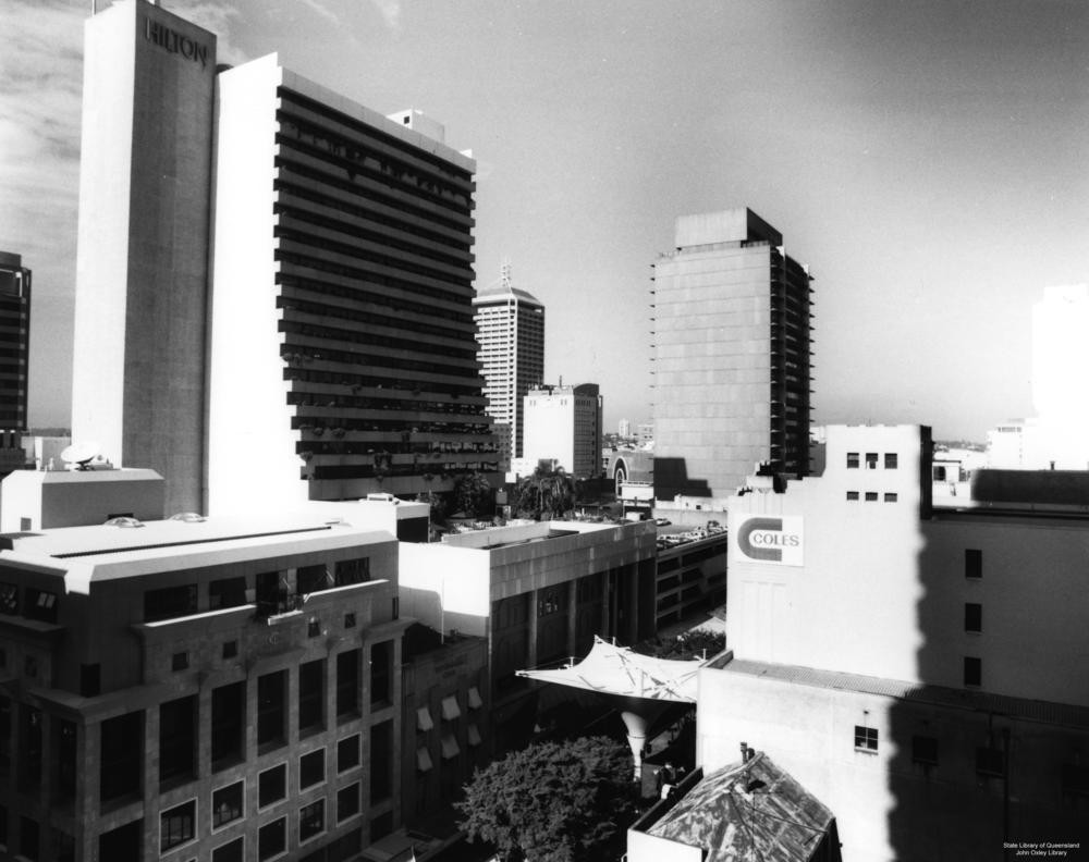
The main street of Brisbane, Queen Street has been extensively documented, particularly by the camera, since Brisbane's earliest times.
In this series of images, from the John Oxley Library's photograph collection, we see the street develop from an unsealed and rough track to a modern city street, with the Queen Street mall as its central feature.
Comments
Your email address will not be published.
We welcome relevant, respectful comments.