The suburb of Oxley is situated to the west of Oxley and Blunder Creeks and is bounded on the north by the Brisbane River. It is named after Oxley Creek which was first marked by John Oxley during his explorations of 1823. Oxley originally named the watercourse Canoe Creek but soon after this, Edmund Lockyer, during his survey of the Brisbane River, named it Oxley Creek in honour of his predecessor.
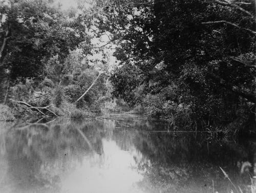
The area that is now known as Oxley has been an important place to Aboriginal people for thousands of years. The banks of Benarrawa, the original name for Oxley Creek, were home to clans such as the Yerongpan and Chepora, part of the Yugara and Yugarabul peoples. Surrounded by dense forest and abundant wildlife like Kangaroos (Murri), Koalas (Dumbirrbi), Turtles (Binkin), and Black Swans (Marutchi), This area also served as a Kul'gun (Transit trail) for other clans travelling throughout the region. Many traditional land management and hunting techniques were used around Benarrawa, such as firestick farming and the use of ingenious fishing methods like traps and chemical stunning. The Oxley Creek Catchment Association has much more information on pre-settlement Oxley, and you can also find out more about First Nations history and language through out interactive map here.
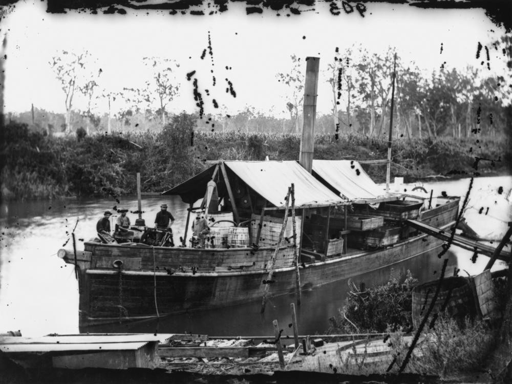
A significant portion of the area now encompassing Oxley was originally leased by Thomas Boyland, in the early 1850s, with the area being known as Boyland's Pocket. This land was later subdivided for small farms, approximately from the 1860s. By the late 1860s the area had grown sufficiently to support a hotel, racecourse, post office and churches. In 1869, a floating sugar mill and cane crushing plant, named the Walrus, was operating in Oxley Creek as well as other places.
In the 1870s, small scale farming progressively diversified into dairying and other agricultural pursuits, for instance bacon processing.
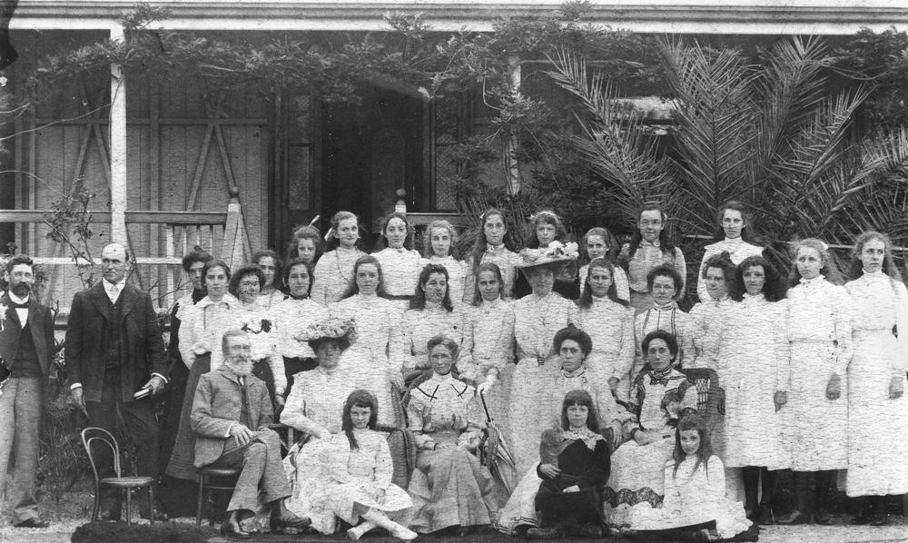
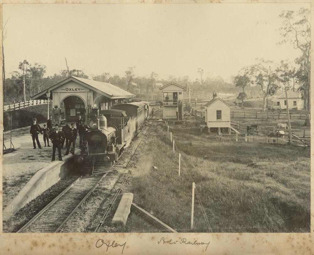
The Brisbane/Ipswich railway line passed through the area in 1876. Further demonstrating the area's growth and importance, the "Duporth" Ladies School moved here from Brisbane in 1888, with the site of this school later becoming the location for an Ursuline Convent (1924-57) and the Canossa Hospital (1965).
Other developments include a sailing club (1902), the Oxley Progress Association (1917) and its hall (1924), the Oxley Golf Club (1929), the Oxley Fire Station (1955), an Ambulance Station (1961) and the Oxley Bowls Club (1967). The southern section of the Oxley Golf Club became the site selected for the development of the Oxley Police Academy.
A significant historical site in the suburb is the Oxley War Memorial, dating from 1920 and moved in 1980. The firm of stone masons which constructed this memorial was F. Williams & Co of Toowoomba, with the original cost being approximately 110 pounds. It is constructed of sandstone and marble and was built in honour of those from the district who fell in the First World War. This memorial is listed on the Queensland Heritage Register.
Brian Randall - Queensland Places Coordinator, State Library of Queensland
Comments
Your email address will not be published.
We welcome relevant, respectful comments.