Queensland artist explores conceptual landscapes via historical maps
By JOL Admin | 14 May 2013
Guest blogger: Megan Cope, artist
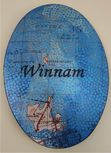
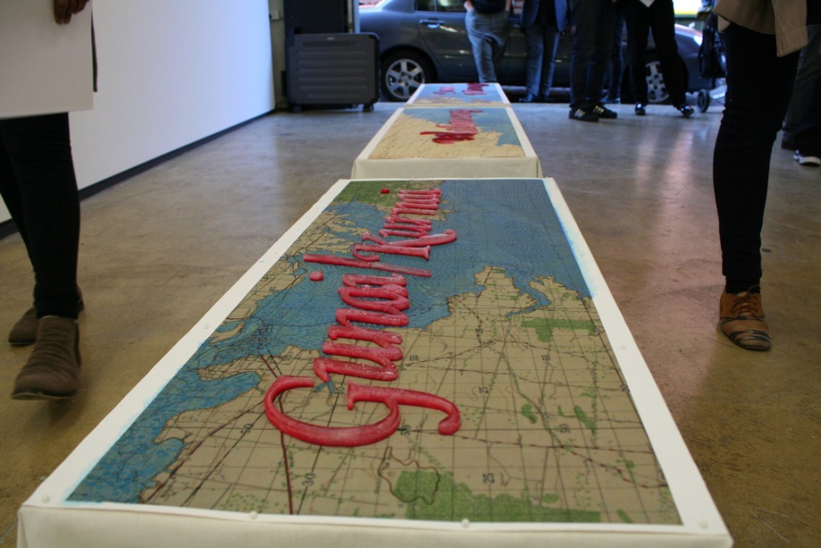
Megan Cope has created new knowledge for all by using recently digitised State Library military maps. A descendant of the Quandamooka people from North Stradbroke Island, this Queensland artist explores decolonising methodologies which have become a primary concern in her work.
A series of her paintings, titled 'After the Flood' and more recently 'Fluid Terrain', will be part of the 'My Country, I still call Australia Home' Exhibition (QAGOMA: June 1, 2013). Here, Megan has used digitised Australian Military Topographical Survey Maps from the John Oxley Library as a base to discuss her ideas of ownership, identity, environment and history. And more specifically, to explore how these notions inform each other and Australians as a people.
Megan uses the military maps from the 1930s and 40s to reference the social climate of Australia at the time and highlight Aboriginal people’s position within that cultural landscape which appears largely devoid or invisible. She inserts their position back into the landscape via the inclusion of the Aboriginal language (Aboriginal groups and place names) in correlation to the geographic space it is this aspect that is often the most visible at first.
Comments
Your email address will not be published.
We welcome relevant, respectful comments.