It is inevitable that a river as large as Brisbane’s, situated as it is in a place with a sub-tropical climate, with periodic heavy seasonal rainfall, sometimes predictable and sometimes not, will flood. The height and severity of these periodic floods is largely dependent on the volume and time-span of rainfall, but other factors also play a significant role. We know from recent experience that the river’s meandering course, as it winds around and past Brisbane’s riverside suburbs and landmarks creates obstacles for the flow of water, especially when heavy rain causes the flow to be greater than normal. These curves and bends in the river’s course, make it difficult for the increased flows from up the river to be discharged quickly into Moreton Bay, and the level rises as a consequence.
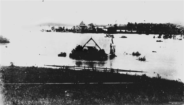
A further factor is the nature of the river’s banks. These are relatively high but beyond the banks, the land tends to be flat and broad and once the level of the river rises as a result of flooding rains and the tops of the banks are reached and exceeded, the floodwaters can spread quickly across those areas closer to the river.
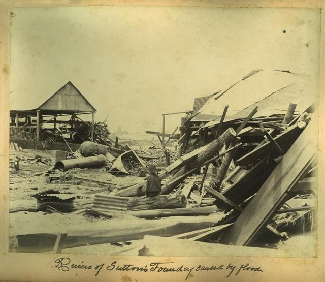
The evidence presented to us through the records of the various floods that have occurred previously in the Brisbane River, at least during the period of European settlement, tend to bear out these factors. By their nature, floods are only predictable to a limited extent, especially as regards height, severity and length of time taken for flood levels to fall. Again, as shown by recent experience, flooding in the river tends to occur very quickly, often with limited warning as the water level rises rapidly as a result of heavy falls of rain. Also, as previously mentioned, once the river’s banks are reached and exceeded by flood waters, large areas of the city can quickly be inundated.
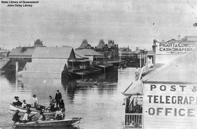
Very severe floods happen infrequently but this is not always the case. Severe flooding has occurred in the Brisbane River in 1887, 1889, 1890, 1893 and 1908 with a break to 1931. The next major flooding of the Brisbane River took place in 1974, some forty-three years later and around thirty-seven years passed between the 1974 inundation and the present flooding. Prior to 1887, major flooding occurred in 1841 and 1844, again with a significant period of time passing between the 1844 and the 1887 floods.

The severity of floods in the Brisbane River therefore tends to be somewhat random and unpredictable, with many smaller floods causing periodic inundation and damage. These smaller floods tend to be overshadowed by the larger, more dangerous floods. The larger, more devastating floods obviously occur less frequently and often with significant periods of time passing between each. But the duration of these gaps between the major floods tends to only be within the realm of guesswork, with averages used to describe then, for instance, a one in fifty year flood or a one in one hundred years. With the passing of time, memories of the last flood fade or become clouded. Those who do remember, either from their own, first hand experience, or from what they have read or been told, tend to think of the last flood as the worst that has ever occurred. But this is not the case and the 1974 flood, prominent in many people’s memories, as well as the present flood was not the highest experienced by Brisbane. The 1974 flood was the worst experienced by Brisbane during the 20th century however, however both the 1841 and 1893 floods were, based on existing records, significantly higher.
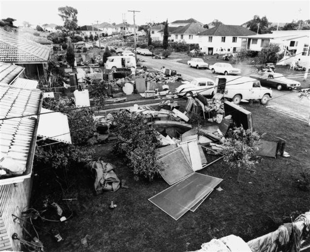
There are also references to even older, more severe floods. For instance, in 1824, John Oxley, during his explorations, mentioned seeing evidence of a severe flood in the area north of the junction of the Brisbane and Bremer Rivers. This he estimated at around fifty feet above the normal level of the two rivers. A year later, in 1825, Major Edmund Lockyer mentioned evidence of a flood in the area of today’s Mount Crosby pumping station. Based on grass and other debris high on tree branches, his estimate was a flood of some one hundred feet above the normal river level. If we take the official record of the flood level on 4 February 1893 at the pumping station, 94 feet 10.5 inches, it has been suggested that between John Oxley’s visit in September, 1824 and Lockyer’s visit in September, 1825, the river experienced a flood as great as that subsequently experienced in February 1893.
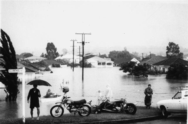
Therefore, we have a number of major floods in the Brisbane River, that we can describe as being catastrophic in size and severity, 1824-5, 1841, 1893, 1974 and 2011, well spaced for sure, but not evenly or predictably spaced. With five huge floods over a period of some 185 years, we can say that the river experiences a major inundation, on average, every 37 years or so. Therefore descriptions such as a one in fifty year flood tend not to adequately portray the reality of the historical record. Of course, in terms of potential damage, there are mitigating factors such as new dams and improved drainage, however the growth and greater density of Brisbane also progressively increases the risk. As well, any mitigating factors can always be negated by a few more feet more of flood waters, unpredictably or rapidly delivered.
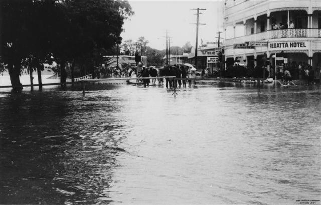
In any examination of flooding in the river, we are faced with the rather stark evidence of the historic record. Regardless of the way in which planners, commentators and others attempt to describe the height and severity of floods, as well as their frequency, nature operates in accord with its own timetable. Unfortunately, it seems that the only certainty is that the river, from time to time, will flood in a devastating fashion, with our only defence being the ways in which we plan and build in the future.
Comments
Your email address will not be published.
We welcome relevant, respectful comments.