Mount Pleasant Heights, [Holland Park and Greenslopes], 1918 (Map of the Week)
By JOL Admin | 26 June 2017
State Library of Queensland has an extensive collection of historical maps of Queensland, some of which have been digitised and can be viewed online.
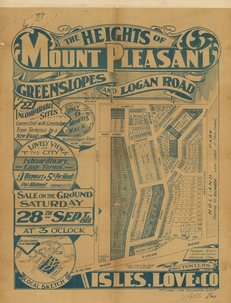
The heights of Mount Pleasant: Greenslopes and Logan Road, 1918. John Oxley Library, State Library of Queensland
This real estate map from 1918 advertises 227 allotments of land for sale at Mount Pleasant Heights estate in the Brisbane suburbs of Holland Park and Greenslopes. The allotments were situated along Abbotsleigh Street, First Avenue (now Beryl Crescent), Second Avenue (now Raff Avenue), Third Avenue (now Love Street), Fourth Avenue (now Percival Terrace), Wilma Street (today spelled Wylma Street) and an unnamed street (now Melba Crescent).
Prior to the sale extensive publicity was published in Brisbane newspapers.
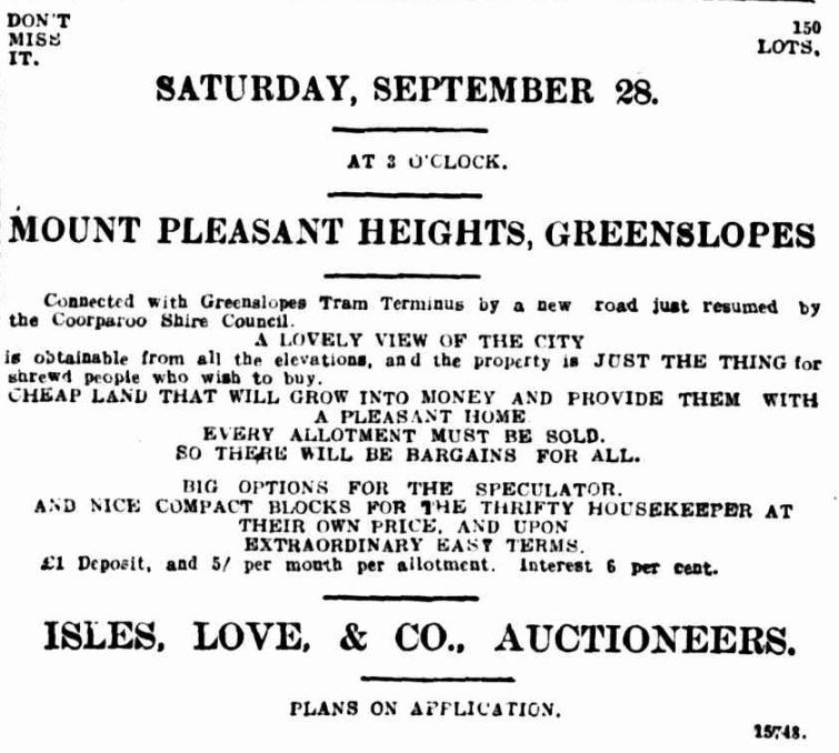
Advertisement, Brisbane Courier, September 14, 1918
"Connected with Greenslopes Tram Terminus by a new road just resumed by the Coorparoo Shire Council. A lovely view of the city is obtainable from all the elevations, and the property is just the thing for shrewd people who wish to buy". (Brisbane Courier, September 14, 1918)
A public auction was held at the site on the afternoon of September 28, 1918.
A higher resolution image of this map can be viewed and downloaded through our One Search catalogue.
Prints of this map are also available through the Library Shop.
You can browse a compendium of our previous maps of the week on our blog.
Myles Sinnamon – Project Coordinator, State Library of Queensland
Comments
Your email address will not be published.
We welcome relevant, respectful comments.