Hemmant Park Estate, Hemmant, 1924 (Map of the Week)
By JOL Admin | 26 October 2018
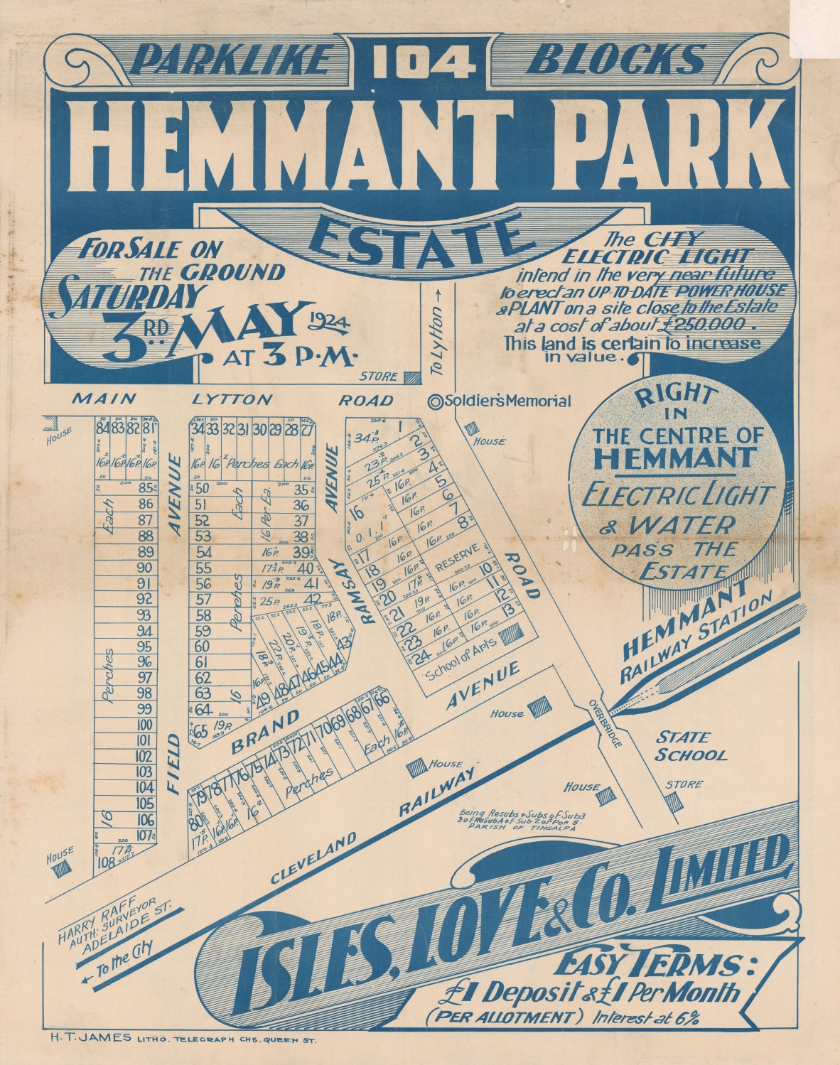
Hemmant Park Estate, Hemmant, Brisbane, 1924. John Oxley Library, State Library of Queensland
This real estate map from 1924 advertises 104 allotments of land for sale at the Hemmant Park Estate, located in the Brisbane suburb of Hemmant. The allotments were situated along Field Avenue, Lytton Road, Ramsay Avenue (now Ramsay Road), Brand Avenue (now Marigold Street and Brand Street) and an unnamed road (now Hemmant Tingalpa Road).
Prior to the sale extensive publicity was published in Brisbane newspapers.
"Facing the main road, right in the heart of Hemmant, close to the business area, and opposite the Soldiers' Memorial...Electric light and water pass the estate and this land is sure to increase in value..." (The Telegraph, 26 April 1924, p.20)
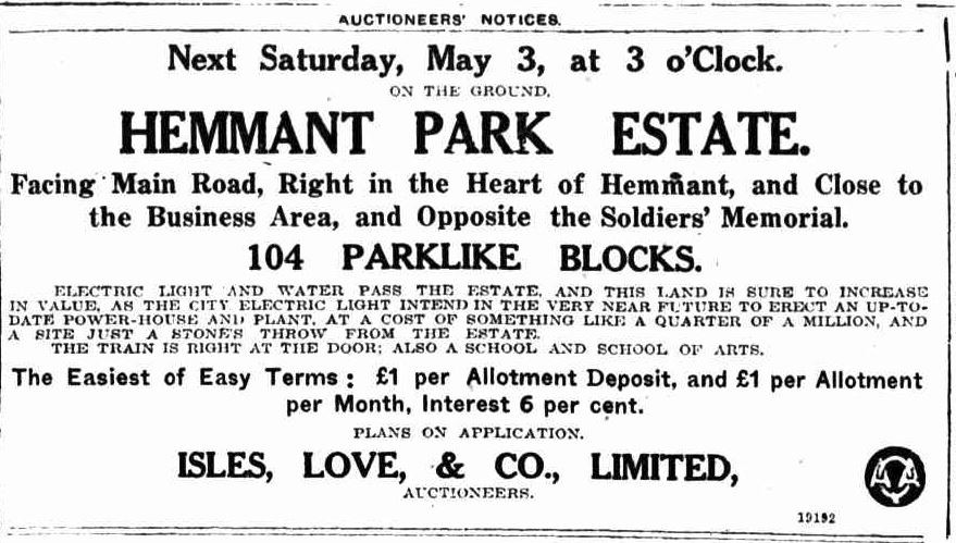
Advertisement for the Hemmant Park Estate. Published in The Telegraph (Brisbane), 26 April 1924, p.20
A public auction was to be held at the site on the afternoon of 3 May 1924. The results of the sale do not appear to have been published in Brisbane newspapers.
A higher resolution image of this map can be viewed and downloaded through our One Search catalogue.
Prints of this map are also available through the Library Shop.
You can browse a compendium of our previous maps of the week on our blog.
Myles Sinnamon – Engagement Officer, State Library of Queensland
Comments
Your email address will not be published.
We welcome relevant, respectful comments.