Have you ever been disappointed by the quality of digitised maps? If you have, then we have excellent news for you.
State Library is progressively adding a zoom-able JPEG2000 derivative to already digitised maps since the new standard was introduced in April 2012. We are starting with 63 estate maps and then moving on to the remaining 1200 or so maps of all types in order to add the JPEG2000 feature. We hope that the new JPEG2000 display will greatly enhance your online map experience.
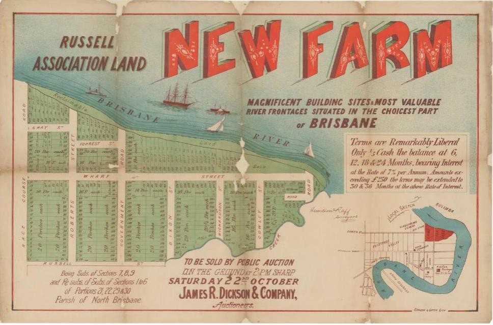
In another area, we are also really pleased to announce a new project to digitise Estate maps commencing in February. We will digitise up to 50 maps per month over the next 12 to 18 months from a collection of 700. The real estate maps are not only beautiful, they are also a wonderful resource for the study of local history. They are invaluable in the study and documentation of urban landscapes as they show the development and the opening up of areas for residential and suburban development. They are an important resource for the study of localities, street names and also house and building histories. Real Estate maps often show photographs or artists representations of places. Some of these may be very early and in the case of artists representations can sometimes predate photographs of an area. These newly digitised maps will automatically have the JPEG2000 feature.
Some useful tips for using the digital viewer have been provided here: https://www.slq.qld.gov.au/research-collections/one-search-catalogue/one-search-help
Comments
Your email address will not be published.
We welcome relevant, respectful comments.