The Australian and New Zealand Map Society Conference 2010
By JOL Admin | 14 May 2010
The Australian and New Zealand Map Society held their annual conference in Adelaide this year. The title of the conference was Mapping Climate: an Environment for Change. The conference papers were delivered by an interesting mix of cartographers, historians, scientists and librarians.
The conference was opened by the Hon Dr John Bannon AO, the former South Australian Premier (1982-1992) who is also a respected historian. His paper entitled Highly Favoured by Nature? Mirageous South Australia, was an informative and excellent introduction to the non South Australians – Dr Bannon is a charismatic personality and an eloquent speaker.

Keynote Speaker Dr John Bannon
Two papers of interest to me were by Martin Woods, the Curator of Maps at the National Library of Australia, and Maggie Patton, Map Librarian, Mitchell Library. Martin’s paper The National cartographic collection as a resource for climate analysis, discussed the uses of older, historic maps and their use when looking at climate change – he mentioned some Qld maps held here at the State Library that have their uses for mapping climate. One such map is the 1900 Queensland Artesian Waters map which shows towns, rivers, some physical features and artesian waters. Martin also mentioned the wonderful Atlas of the colony of Queensland, Australia, 1865 and the old and new series of the Queensland 4 Mile Series published from the 1930-s through to the 1970’s (also held at SLQ).
Maggie's paper, "Primary evidence- rare surveys of Eastern Australia from the Sir William Dixon Collection" looked at the incredible map collection held in the Mitchell Library of the State Library of New South Wales. This collection is currently being digitised, and the map below (which unfortunately the State Library of Qld does not hold!) is a fine example of what is held in the collection. This map is the George Barney 1839 Plan of Brisbane Town –
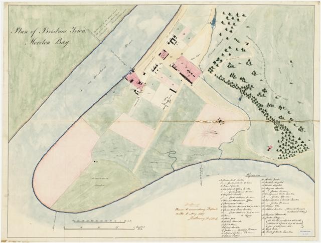
A common thread through many of the papers was the influence of George Goyder in South Australian climatic history. Goyder was the Surveyor-General of South Australia from 1861 until 1893. He analyzed the patterns of South Australian climate, and drew his famous "line" that delineated the areas of rainfall and suitability of the state for agriculture. I especially liked Goyder’s comment of the South Australian climate when he claimed "this country is nomadic"! What a perfect description of Australian weather patterns!
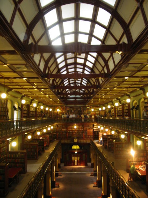
The Conference attendees were lucky to have a guided tour of the Library of the Royal Geographical Society of South Australia. This is housed in the beautiful Mortlock wing of the State Library. The Library’s collection is awesome!
Comments
Your email address will not be published.
We welcome relevant, respectful comments.