Ashgrove East, Section 1, Brisbane, 1889 (Map of the Week)
By JOL Admin | 5 September 2016
State Library of Queensland has an extensive collection of historical maps of Queensland, some of which have been digitised and can be viewed online.
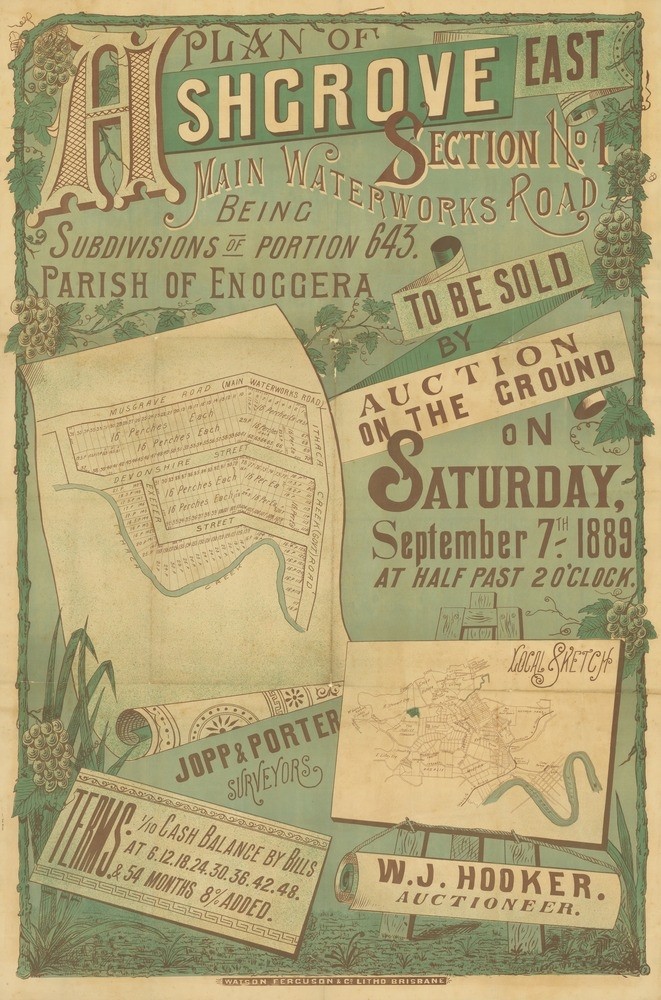
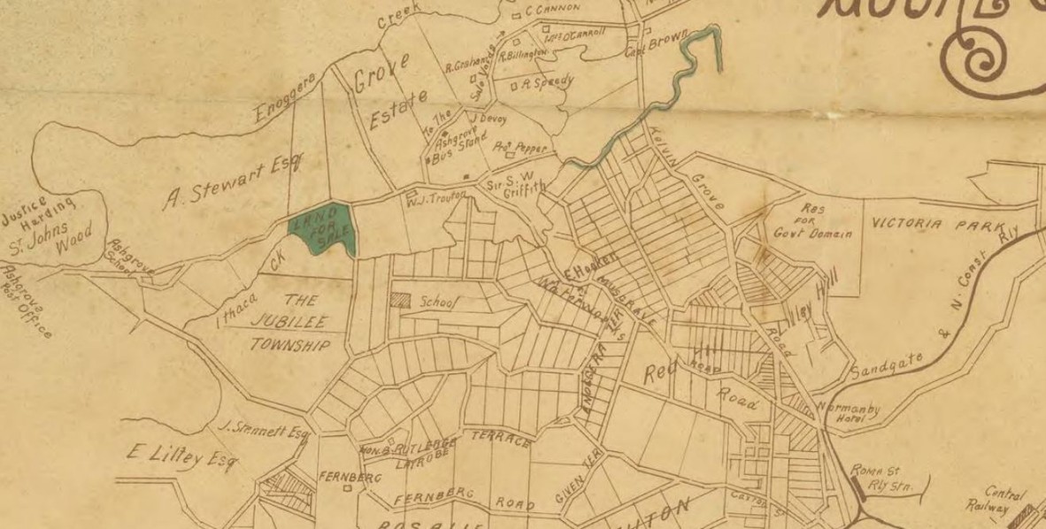
This real estate map from 1889 advertises 149 allotments of land for sale at the Ashgrove East estate in the Brisbane suburb of Ashgrove. The allotments were situated along Waterworks Road, Devonshire Street, Exeter Street and Ithaca Creek Road (now Jubilee Terrace).
Prior to the sale extensive publicity was published in Brisbane newspapers –
"The situation is elevated, commanding splendid views, with a beautiful slope from the 37 lots fronting the main Waterworks road down to the Ithaca Creek, to which it has 33 frontages. The soil is excellent for gardening purposes, splendid residence sites, and well deserving the attention of the poor man and the speculator...There is a regular established line of omnibuses running at short intervals from early morning till late at night between Grove Estate and Eagle street...and permission has already been granted for an electric tramway from Roma street along the Waterworks road...". (The Telegraph, Brisbane, September 6, 1889)
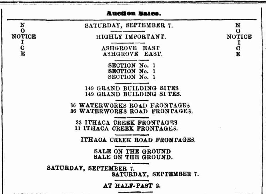
A public auction was held on the estate on the afternoon of September 7, 1889. The Brisbane Courier newspaper reported the results of the sale –
"W.J. Hooker reports a successful sale in Ashgrove East to-day. The attendance was good, and thirty-six allotments were disposed of for a total sum of £1223 6s 8d, being an average price of £340 per acre." (Brisbane Courier, September 9, 1889).
A higher resolution image of this map can be viewed and downloaded through our One Search catalogue.
Prints of this map are also available through the Library Shop.
You can browse a compendium of our previous maps of the week on our blog.
Myles Sinnamon – Project Coordinator, State Library of Queensland
Comments
Your email address will not be published.
We welcome relevant, respectful comments.