State Library of Queensland has an extensive collection of historical maps of Queensland, some of which have been digitised and can be viewed online.
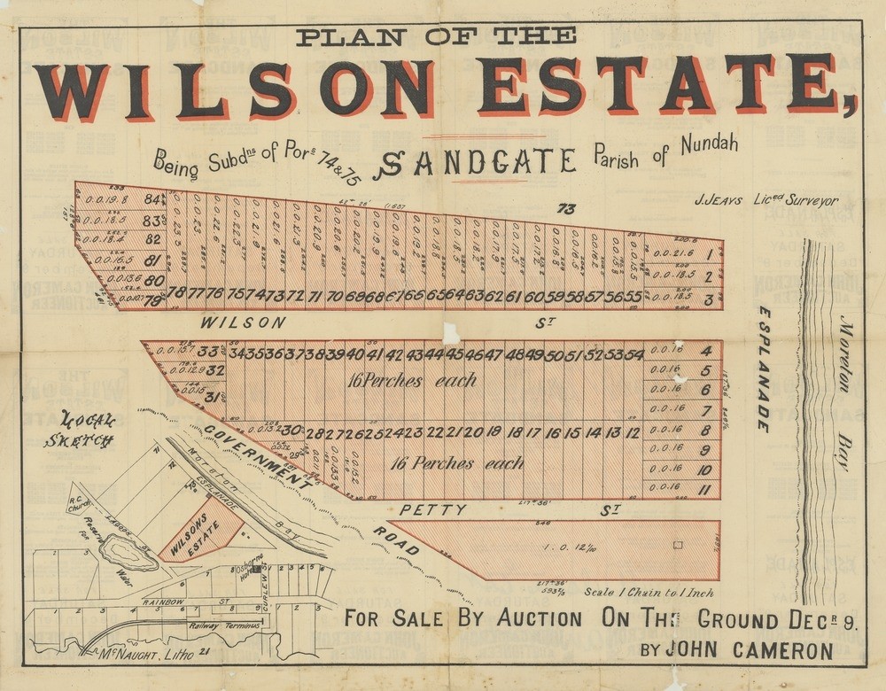
Plan of the Wilson Estate, Sandgate, 1882. John Oxley Library, State Library of Queensland
This real estate map from 1882 advertises 84 allotments of land for sale at the Wilson Estate in the Brisbane suburb of Sandgate. The allotments were situated on Petty Street (now First Avenue), Wilson Street (now Second Avenue), Esplanade (Flinders Parade) and an unnamed government road (now Cliff Street and Brighton Road).
Prior to the sale extensive publicity was published in Brisbane newspapers.
"The bathing ground directly in front of the Wilson Estate is the best in the whole of the township, being a fine sandy bottom, and with good depth of water at high tide...With regard to the fishing, the auctioneer can attest by personal experience that the whiting fishing in front of the estate is the best to be had in Sandgate waters, the fish coming in over the sandy shoals in large schools with each tide." (Brisbane Courier, December 1, 1882)
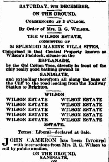
Advertisement, Brisbane Courier, December 1, 1882
A public auction was to be held at the ground on the afternoon of December 9, 1882. The results of the sale do not appear to have been published in Brisbane newspapers.
A higher resolution image of this map can be viewed and downloaded through our One Search catalogue.
Prints of this map are also available through the Library Shop.
You can browse a compendium of our previous maps of the week on our blog.
Further reading
- Nashville Estate, Sandgate, 1882 (real estate map)
Comments
Your email address will not be published.
We welcome relevant, respectful comments.