State Library of Queensland has an extensive collection of historical maps of Queensland, some of which have been digitised and can be viewed online.
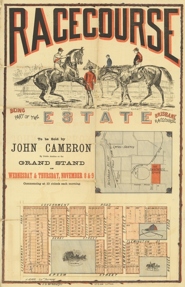
Racecourse Estate, , Brisbane, 1882. John Oxley Library, State Library of Queensland
This real estate map from 1882 advertises 187 allotments of land for sale at the Racecourse Estate, located today in the Brisbane suburb of Hendra. The allotments were bounded by Nudgee Road, Epsom Street (now Manson Road) and two unnamed government roads (now Gerler Road and Zillman Road) and situated close to the Eagle Farm Racecourse.
Prior to the sale extensive publicity was published in Brisbane newspapers.
“The Racecourse Estate comprising about 200 splendid villa sites, situate on, and forming part of, the Brisbane racecourse property, with frontages to three government roads, with the railway station within a short distance of the allotments, and two of the best roads leading out of the city running on the north and south sides of the Estate.” (The Telegraph, November 2, 1882)
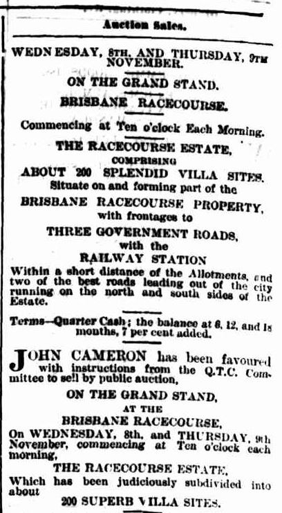
Brisbane Courier, October 19, 1882
The public auction was to be held at the racecourse on the mornings of November 8th and 9th, however according to the Brisbane Courier the sale on the 8th was cancelled due to "the inclemency of the weather". The newspaper followed-up by promoting the auction on the morning of November 9th.
“At 10 o’clock John Cameron will take up a position somewhere in the vicinity of the Grand Stand, and begin the sale, which will be carried on up to 12 o’clock, the time of the starting of the first race. As the whole of the allotments are very choice, we anticipate the bidding will be spirited and the sale satisfactory.” (Brisbane Courier, November 9, 1882)
The results of the sale do not appear to have been published in The Telegraph or Brisbane Courier newspapers.
This map, McKellar's official map of Brisbane and suburbs (map 3), shows how this estate looked in 1895.
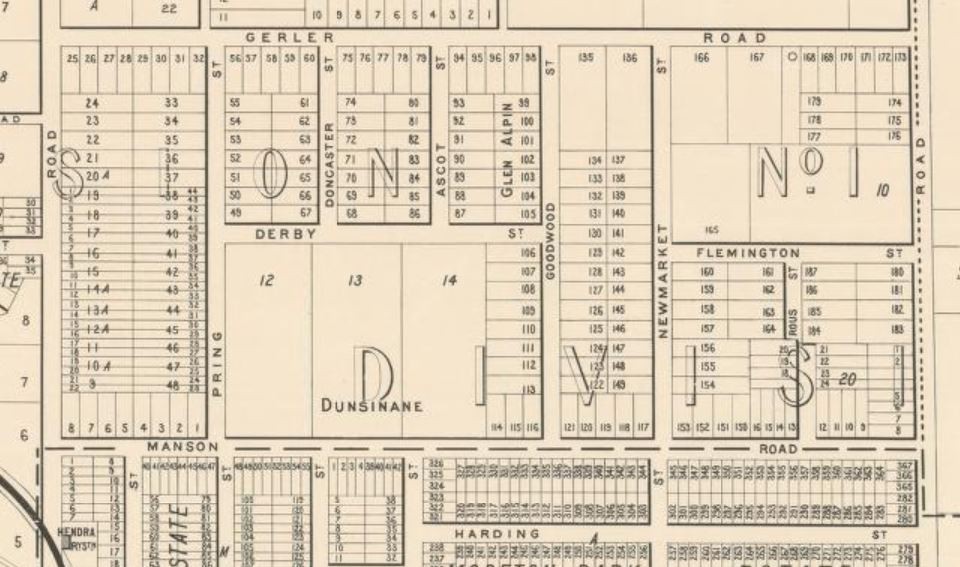
McKellar's official map of Brisbane & suburbs, 1895. (Map 3). John Oxley Library, State Library of Queensland
A higher resolution image of the Racecourse Estate map can be viewed and downloaded through our One Search catalogue.
Prints of this map are also available through the Library Shop.
You can browse a compendium of our previous maps of the week on our blog.
Myles Sinnamon – Engagement Officer, State Library of Queensland
Comments
Your email address will not be published.
We welcome relevant, respectful comments.