Opening up the Conversation: STEAM into STEM – Mapping
By administrator | 16 March 2015
Dr Kathy Mackey, Manager of the Queensland Academies, will be undertaking a Smithsonian Fellowship in 2015 as part of her ongoing research into how the cultural and education sectors can partner more effectively in order to influence the development of design thinking as a more explicit form of inquiry based pedagogy across all areas of the curriculum. The Queensland Academies Partnerships Online Program for students in years 5 – 9 is based on three interrelated forms of inquiry processes – scientific inquiry, research methodologies and design thinking. Kathy’s Fellowship aims to develop an innovation thinking strategy that combines elements of these process as a new form of contemporary pedagogy that places the role of cultural partners central to this innovation inquiry; thus driving contemporary education discourse in Queensland around STEM into STEAM. Kathy is sharing her experiences through the APDL blog.
As I commence creating a series of critical thinking blogs aimed at students in Year 5 – 9 based on my experiences within the collections of the Smithsonian Museum, I also have the opportunity to open up a discussion around utilising primary resources as stimuli for STEAM.
Rather than focusing on “school subjects” as defined by the curriculum and timetables as we know it, the STEM/ STEAM discourse allows us to utilise thinking about knowledge processes including design thinking, scientific inquiry and research methodologies. Furthermore, it allows us to utilise a more polymathic perspective including overarching conceptual domains including mapping to create learning based on critical thinking and global citizenry.
A useful reference here is the International Baccalaureate Organisation’s Middle Years Programme Design Guide that emphasises the relationships between design, technology and societal change at a macro level, by challenging students to question the role of information, communication and the environment within problem making and solving. This creates an opportunity for design-based thinking to become central to a range of pedagogical frameworks.
As is well supported across a range of literature, "Design is the link between innovation and creativity, taking thoughts and exploring the possibilities and constraints associated with products or systems, allowing them to define and manage the generation of further thought through prototyping, experimentation and adaption. It is human-centred and focuses on the needs, wants and limitations of the end user.” (International Baccalaureate Organisation, 2015, p.4)
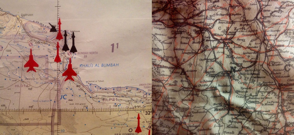
The two images above refer to maps utilised by surveillance operatives in the World War 2 and the first Gulf War of 1990-1 and are located in the National Air and Space Museum. These can be considered as mathematically driven spatial tools, designed with an outcome grounded in representation. However as Denis Cosgrove suggests, "To map is in one way or another to take the measure of a world... In such way that it may be communicated between people, places and times. The measure of mapping is not restricted to the mathematical; it may equally be spiritual, political or moral." (Cosgrove, 1999, p.2)
Similarly, author Jeanette Winterson positions a map as a literary device grounded in aesthetics, "A map can tell me how to find a place I have not seen, but have often imagined. When I get there, following the map faithfully, the place is not the place of my imagination. Maps, growing ever more real, are much less true." (Jeanette Winterson, 1995, p.81)
Maps provide an obvious entry for STEAM conversations with all ages, in particular as our culture is saturated with images associated with social networking that provides a mechanism for humans to actually be embodied in our processes daily navigation. That said, a simple walk from home to school or along the beach is a form of human navigation that provides many opportunities in the arts as well as discusses related to time and space. Links between maths, politics, visual art, geography, satellite imagery, surveillance, economic power global conflict and the weather are visualised by the technologies of cartography.
References:
Cosgrove, D. (Ed.). (1999). Mappings. London: Reaktion Books.
International Baccalaureate Organisation. (2014). Middle Years Programme Design Guide Cardiff: International Baccalaureate Organisation.
Winterson, J. (1995). Arts and Lies. London: Jonathan Cape.
Comments
Your email address will not be published.
We welcome relevant, respectful comments.