State Library of Queensland has an extensive collection of historical maps of Queensland, some of which have been digitised and can be viewed online.
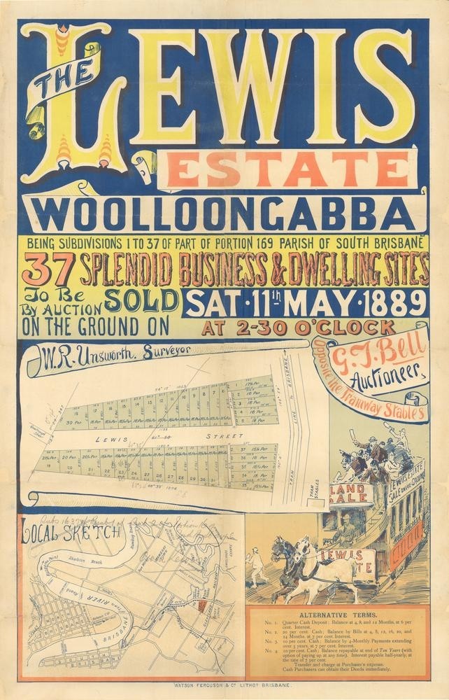
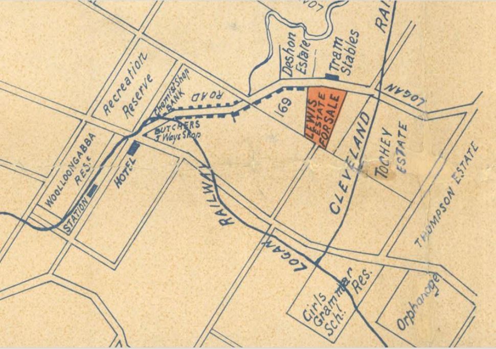
The Lewis Estate, Woolloongabba being subdivisions 1-37 of portion 16 of Parish of South Brisbane. Map from 1889. John Oxley Library, State Library of Queensland
This Brisbane real estate map from 1889 is advertising 37 allotments of land for sale at the Lewis Estate in the Brisbane suburb of Woolloongabba. The allotments for sale were situated along Lewis Street and part of Logan Road.
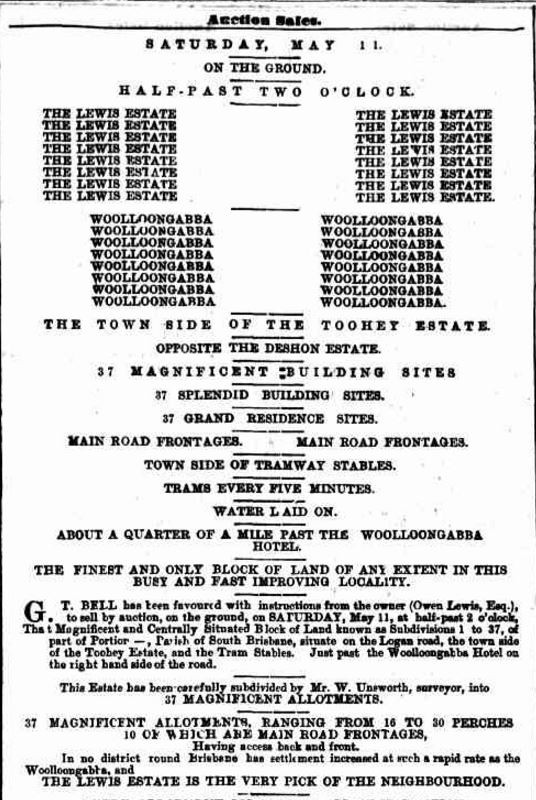
Advertisement in The Telegraph (Brisbane) newspaper, May 4, 1889
A public auction was held at the site on the afternoon of May 11, 1889. The Telegraph newspaper on May 13 published the following report -
"G.T. Bell reports a most successful sale of the Lewis Estate, Woolloongabba on account of Owen Lewis, Esq. The attendance was large and the bidding spirited, every allotment being disposed of at an average for the thirty-seven lots of £214 2s 2d., at prices ranging from £130 to £505, for a total of £7,922..."
You can view a higher resolution image of this map through our One Search catalogue.
Myles Sinnamon – Project Coordinator, State Library of Queensland
Comments
Your email address will not be published.
We welcome relevant, respectful comments.