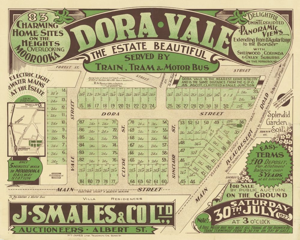
This real estate map from 1927 advertises 83 allotments of land for sale at the Dora Vale Estate in the Brisbane suburb of Moorooka.
The allotments were situated along Dora Street, Vale Street, Clyde Street, Sinclair Street, Beaudesert Road and Main Street (now Gainsborough Street).
Prior to the sale extensive publicity was published in Brisbane newspapers.
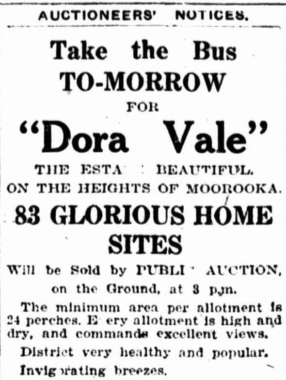
"Every allotment high and commanding good views, and served by tram, train and bus. Electric light and water at Estate, excellent roads.” (Brisbane Courier, 30 July 1927, p.32)
The auction was to have taken place on the afternoon of 30 July 1927.
A higher resolution image of this map can be viewed and downloaded through our One Search catalogue.
Prints of this map are also available through the Library Shop.
You can browse a compendium of our previous maps of the week on our blog.
Browse our collection of digitised real estate maps on Historypin.
Find your Moorooka house in the Frank and Eunice Corley collection
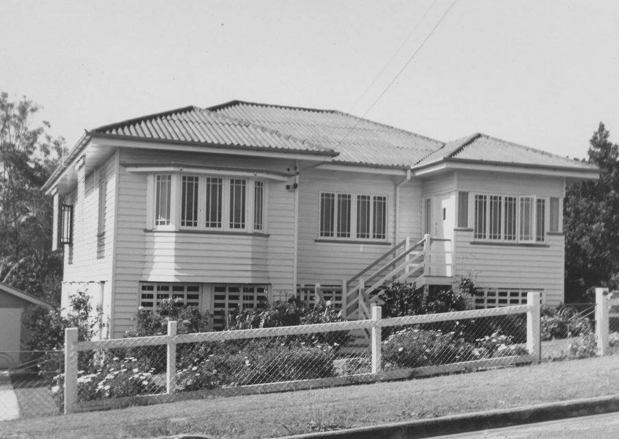
9 Dora Street, Moorooka. From 6169 Frank and Eunice Corley House Photographs. John Oxley Library, State Library of Queensland. Image 6169-3251-0010
From the 1960s to the 1970s, Frank and Eunice Corley drove the suburban streets of Queensland in their pink Cadillac, taking photographs of houses and selling them to homeowners. A database containing over 61,000 photographs can now be searched and viewed online. There are 1,284 photographs for the suburb of Moorooka.
The Corley collection is the focus of State Library of Queensland’s latest exhibition, Home: a suburban obsession, which runs from 7 December 2018 until 14 July 2019.
Myles Sinnamon – Engagement Officer, State Library of Queensland
Comments
Your email address will not be published.
We welcome relevant, respectful comments.