Daly Estate, [Camp Hill], 1925 (Map of the Week)
By Myles Sinnamon - Engagement Officer, State Library of Queensland | 22 July 2019
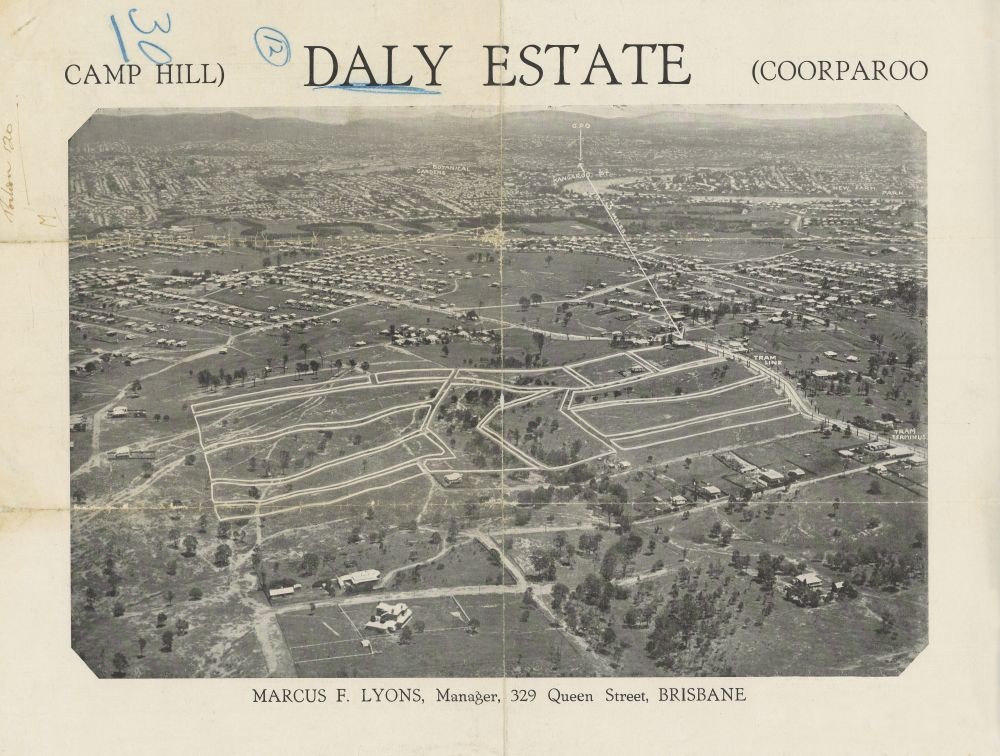
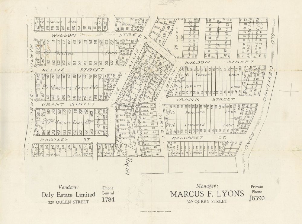
This double-sided real estate map from 1925 advertises land for sale at the Daly Estate, in what is now the Brisbane suburb of Camp Hill. The map shows 337 blocks of land covering Martha Street, Hartley Street, Grant Street, Nellie Street, Albert Street, Old Cleveland Road, Wilson Street (now Carranya Street), Betty Street (now Bovelles Street), Margaret Street (now Sylvia Street) and Frank Street (now Ernest Street). Newspaper reports refer to 500 blocks up for sale in February 1925, possibly suggesting more land was released after this map was published.
Real estate map of Daly Estate, , 1925. John Oxley Library, State Library of Queensland
Brisbane Courier, 11 February 1925, p.11
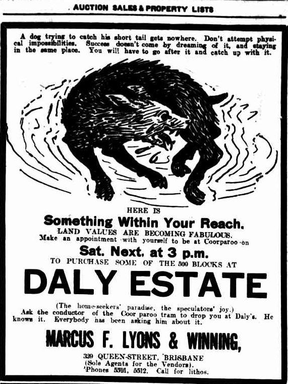
Extensive publicity was published in Brisbane newspapers.
"This land is situated on the recent extension of the Coorparoo tram terminus, at Camp Hill, which is the highest part of Brisbane that so far has not been settled upon. On the northern and western side an uninterrupted view can be obtained of the city, and on the eastern side Moreton Island stands out prominently." (Brisbane Courier, 7 February 1925, p.20)
Brisbane Courier, 11 February 1925, p.11
The opening day sale of the Daly Estate took place on the afternoon of 12 February 1925. The results of the sale were published in The Daily Mail newspaper.
"The 500 blocks of Daly Estate, Coorparoo, which were opened to the public for sale by Messrs Marcus Lyons and Winning on Saturday afternoon attracted a large crowd. In all 115 blocks were sold. Strangely enough, what the agents for the vendors thought was the pick of the estate in one quarter was left untouched because of the scarcity of time in which to cope with the applications. These, together with other allotments, have yet to be sold, and the agents desire to inform those who were disappointed on Saturday to pay them a call during the week, when intending buyers will be motored to the estate. (The Daily Mail, Brisbane, 17 February 1925, p.14)
A higher resolution image of this map can be viewed and downloaded through our One Search catalogue.
Prints of this map are also available through the Library Shop.
You can browse a compendium of our previous maps of the week on our blog.
Browse our collection of digitised real estate maps on Historypin.
Find your Camp Hill house in the Frank and Eunice Corley collection
From the 1960s to the 1970s, Frank and Eunice Corley drove the suburban streets of Queensland in their pink Cadillac, taking photographs of houses and selling them to homeowners. A database containing over 61,000 photographs can now be searched and viewed online. There are 1,502 photographs for the suburb of Camp Hill.
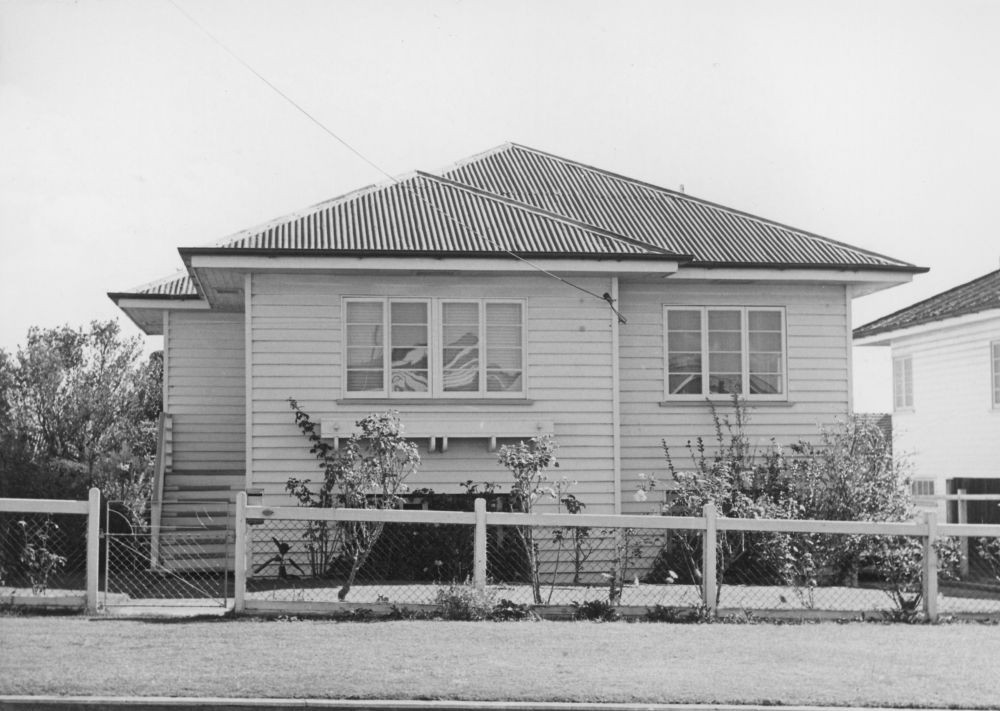
House at 27 Nellie Street, Camp Hill. From Frank and Eunice Corley House Photographs. John Oxley Library, State Library of Queensland. Image 6169-2738-0002
Myles Sinnamon – Engagement Officer, State Library of Queensland
Comments
Your email address will not be published.
We welcome relevant, respectful comments.