Coopers Plains, Homebush Estate, 1886 (Map of the Week)
By JOL Admin | 15 April 2016
State Library of Queensland has an extensive collection of historical maps of Queensland, some of which have been digitised and can be viewed online.
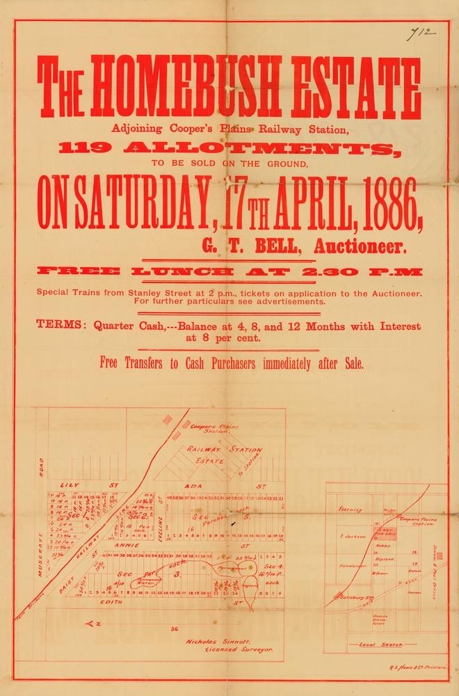
This real estate map from 1886 is advertising 119 allotments of land for sale at the Homebush Estate in the Brisbane suburb of Coopers Plains. According to the map the allotments were situated along parts of Ada Street, Annie Street, Edith Street, Daisy Street, Lily Street and Musgrave Road.
Prior to the sale extensive publicity was published in the Brisbane Courier and The Telegraph newspapers with advertisements highlighting the close proximity of the estate to Coopers Plains Railway Station.
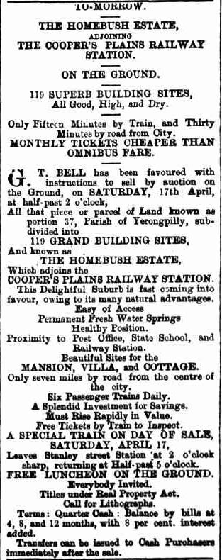
According to publicity the public auction was to be held onsite on the afternoon of April 17. Unfortunately the results of the auction were not published in the newspaper.
You can view a higher resolution image of this map through our One Search catalogue.
Myles Sinnamon – Project Coordinator, State Library of Queensland
Comments
Your email address will not be published.
We welcome relevant, respectful comments.