Conservation treatment of Edmund Kennedy and Alfred Turner’s map of three rivers
By Claudia Husband, Specialist Conservator | 25 September 2026
Alfred Allaston Turner (1826 – 1895) was an explorer and civil servant from France who arrived in Perth on the Eliza on 5 March 1831. In 1846, Turner met Edmund Kennedy (1818 – 1848), an explorer from Guernsey, and together they set off on a journey to the Gulf of Carpentaria. Kennedy was convinced that the Victoria River (later renamed the Barcoo River) flowed into the gulf, but found instead, that it flowed south-west into Cooper’s Creek. Kennedy and Turner continued to trace the river and documented its intersections with the Barwon, Culgoa and Warrego Rivers, naming the Thomson River along the way and documenting the pathways of the three rivers onto one map. State Library of Queensland acquired a collection of items and documentation relating to this expedition, including the map, from Edgar Beale, a descendant of Alfred Turner.
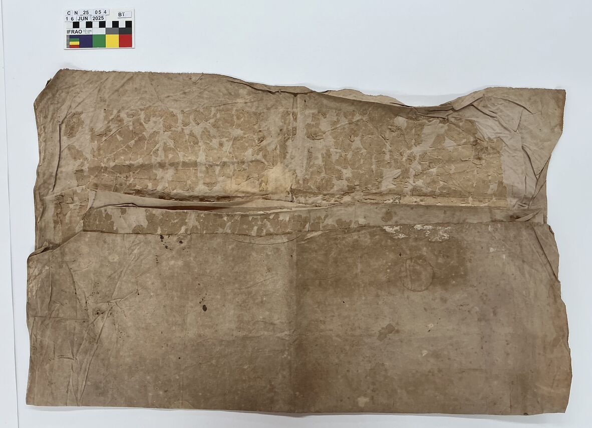
The map before treatment, still folded
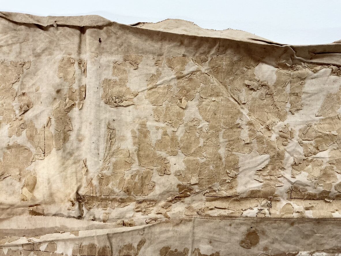
Before treatment, detail
The map came across my bench, and after a brief moment of trepidation, I set to work. The map was drawn with black, blue and red inks on a very thin paper (similar to tissue paper or tracing paper) which had then been adhered to a heavyweight fabric backing. It was initially thought that this fabric may have been linen, but observing it under a microscope ultimately led me to the conclusion that it is made from cotton.
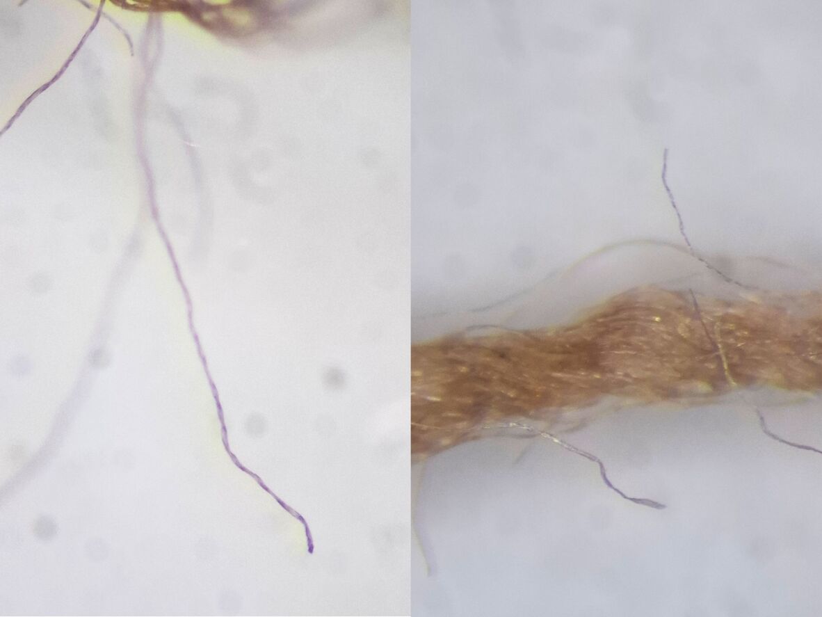
Using a microscope helps us to identify and observe materials in more detail and can aid in material identification. These fibres are flat and slightly twisted, which is characteristic of cotton.
It is quite a common practice in cartography to adhere paper maps to fabric to allow more strength and durability for handling, and it is a material combination that we see quite often. However, as paper degrades, it becomes discolored and brittle and loses much of its structural integrity. Woven cotton, by contrast, tends to be much more stable and degrades more slowly. Although the cotton fabric is very discoloured and stained, it is structurally very stable. Over time, the two materials become materially incompatible which causes the paper to separate from the fabric. In this instance, the paper had become so brittle and fragmented that any sudden movement (even heavy breathing!) would cause the fragments to shift on the surface or become displaced or blown away. In its current state, it was entirely inaccessible. At State Library, that simply won’t do!
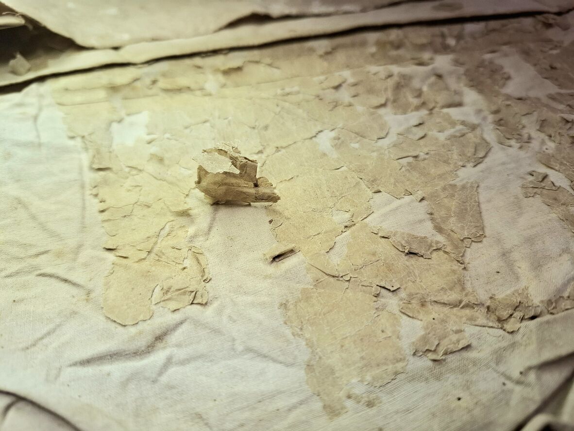
Paper separating from the textile backing
The goal for this treatment was to stabilise it so that it could be digitised and made accessible to the community online, therefore allowing handling of the physical object to be kept to a minimum.
This fragility meant we had to adopt a different approach to treatment. Under normal circumstances, the map would be unfolded and assessed as a whole prior to undertaking any treatment to ensure the selected approach was compatible with the object (and also to avoid any unwanted surprises mid-treatment!). In this instance, unfolding the map would place the object at great risk for two primary reasons:
- As the brittle paper was folded face-to-face, unfolding would lift fragments and disrupt them, possibly dislodging pieces and shifting them to a different location. This would have made re-adhering or trying to locate missing pieces very challenging, and important information may be lost.
- Once unfolded, the map would need to be covered at all times to protect it from the elements. Due to its condition, it was incredibly vulnerable to static, and placing another material on top of the exposed paper could inadvertently cause pieces to be lifted.
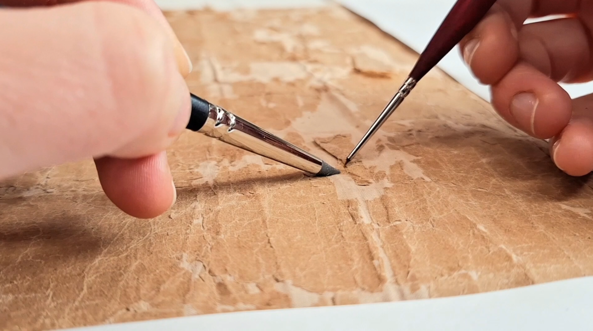
Re-adhering the fragments to the textile with wheat starch paste and a 0000 brush
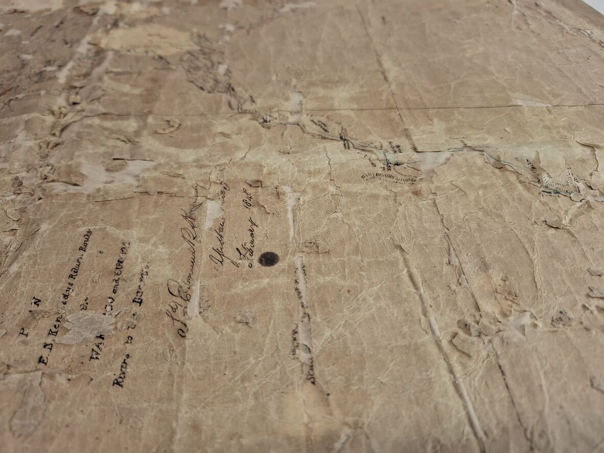
Detail – before treatment
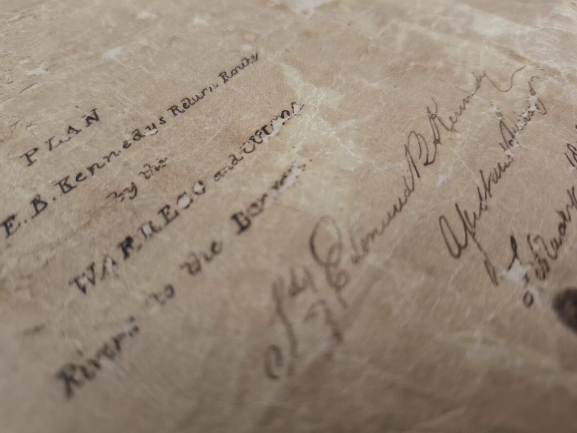
Detail – after treatment
As the map was unfolded, it became apparent that the map was comprised of two pieces of fabric adjoined on one edge to form an L shape and these two pieces of fabric were held together only by the paper map sitting on top. The exact reason for this particular formation is not known, but it is possible that they were simply making the most of the materials available to them, and that it was likely an attempt to be frugal with their supplies.
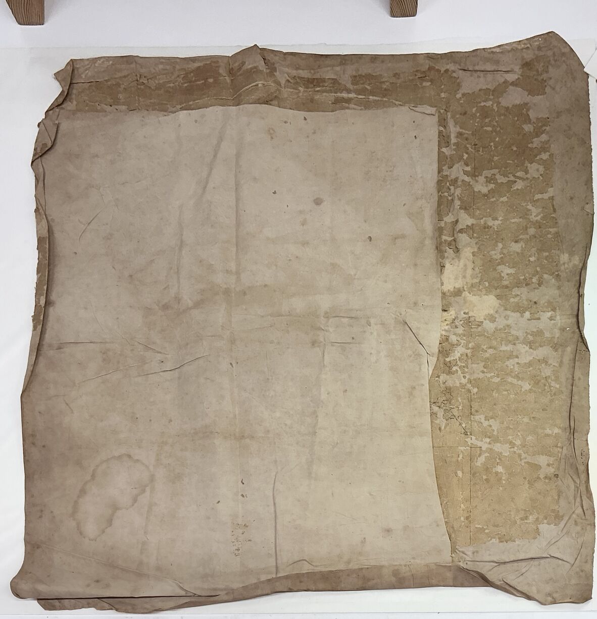
The progressive unfolding of the map revealed the final composition
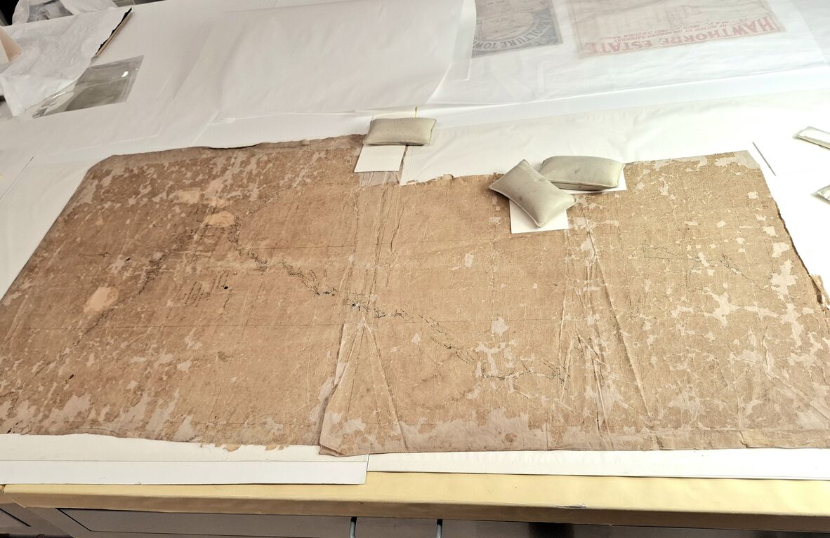
The map fully unfolded, revealing two pieces of fabric joined to create an L shape
Unfortunately, there were many casualties along the way, with many already-displaced fragments unable to be returned to their original location on the map. In many instances, the paper was so fragile that the slightest touch with a brush would cause it to crumble. Thankfully, the majority of these pieces were ‘non-image’ or background areas of the map, thus important information was not lost by their absence.
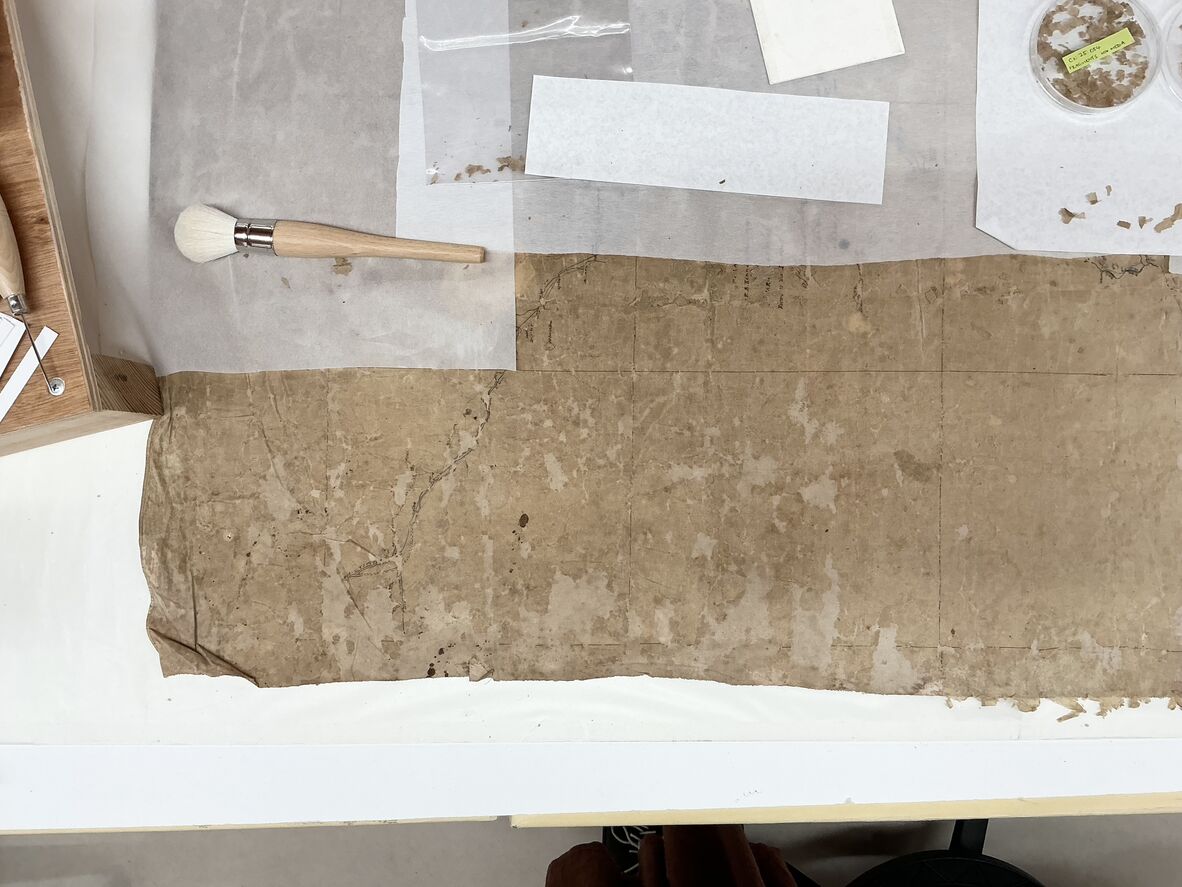
Working on the map section-by-section, keeping treated areas covered with paper to protect them from the elements. Loose fragments were set aside, and any pieces with media on them were kept separately, just in case their original placement could be located later on
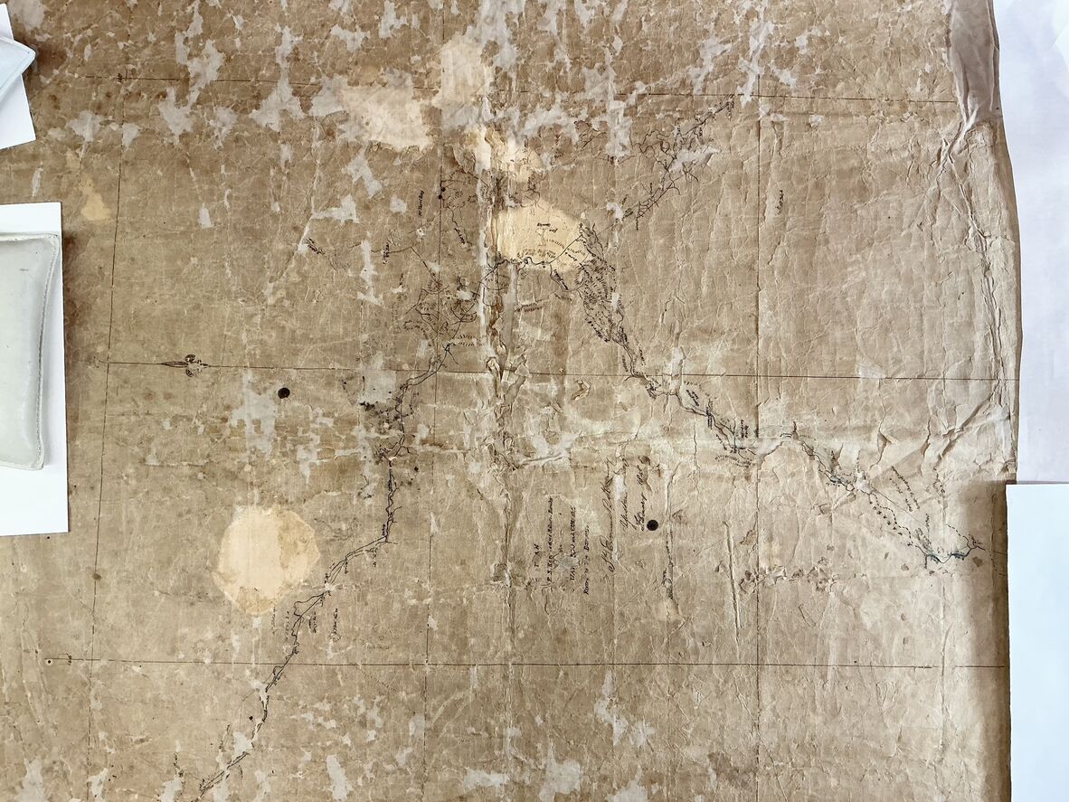
Central section of map, before treatment
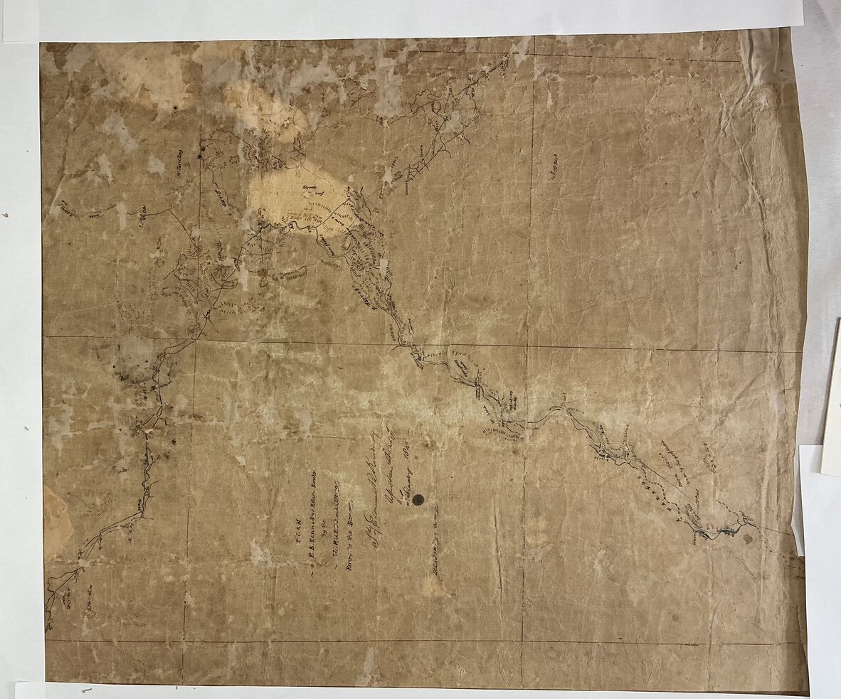
Central section of map, after treatment
After treatment, the map was digitised and housed in a custom 800 x 1600mm folio constructed from archival-grade cardboard, ready for safekeeping in the library’s repositories. As a result of this treatment and digitisation, Kennedy and Turner’s map is now accessible and the details of their expedition can be explored in detail by anyone, anywhere in the world.
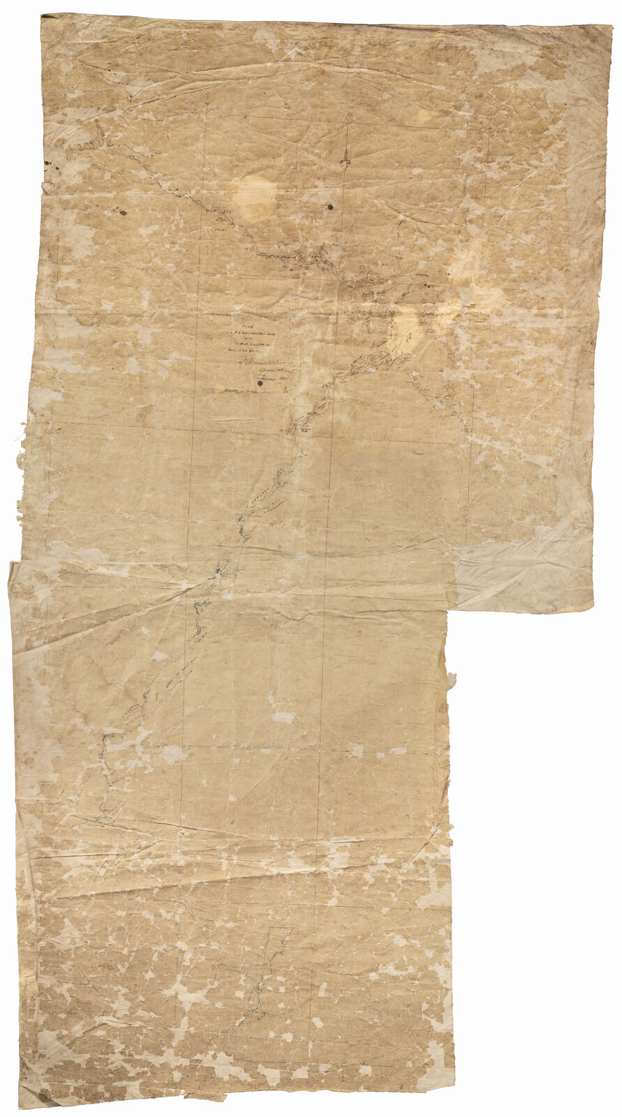
After treatment
The map and several other items from the 34677, Edmund Besley Court Kennedy and Alfred Allatson Turner collection have been digitised and can be viewed via our One Search catalogue.
Comments
Your email address will not be published.
We welcome relevant, respectful comments.