200th anniversary of John Oxley’s exploration of the Brisbane River (Maiwar): Day 4
By Anna Thurgood, Engagement Officer | 5 December 2023
Users are advised that this material may contain culturally sensitive imagery and descriptions which may not normally be used in certain public or community contexts. Annotation and terminology which reflects the creator's attitude or that of the era in which the item was created may be considered inappropriate today. This material may also contain images, voices or names of deceased persons.
In October 1823 John Oxley, Surveyor General for the colony of New South Wales, had been sent north to find a suitable site for a new penal settlement, one that could house the ‘worst of the worst’ re-offending convicts.
Tasked with surveying and reporting back on three sites: Port Bowen; Port Curtis (Gladstone) and Moreton Bay, Oxley was returning from Port Curtis when he entered Moreton Bay in his government brig, the Mermaid, on 29 November 1823.
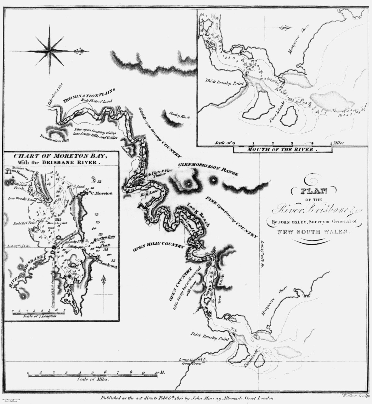
Plan of the River Brisbane and chart of Moreton Bay, as drawn by John Oxley, 1823. Negative no. 69012. John Oxley Library, State Library of Queensland.
He immediately found two former convicts, Thomas Pamphlett and John Finnegan, on Bribie Island who had survived a shipwreck and been cared for by local Aboriginal people. While Oxley suspected a large river entered Moreton Bay, Pamphlett and Finnegan confirmed they had been there.
After a failed attempt to find this river in a small whale boat, where Finnegan accidentally showed Oxley the wrong river, the small party entered the much larger Brisbane River on 2 December1823.
Oxley’s field notebooks are quite brief, mainly about surveying the breadth and depth of the river, but he does describe what he sees around him. We also have his Report of an Expedition to survey Port Curtis, Moreton Bay and Port Bowen, which Oxley wrote and presented to Governor Brisbane in January 1824.
This is part of a series of blog articles covering John Oxley’s journey in Maiwar, the Brisbane River. On this day, 200 years ago, Oxley had travelled upstream as far as Goodna – approximately 50 miles – and returned to the entrance to take soundings and bearings. He was clearly considering this area as a potential site for the penal settlement.
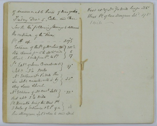
Extract from Field Book: Exploration of Brisbane River, 30 November 1823 – 5 December 1823. John Oxley (surveyor). Item ID: ITM291077. Queensland State Archives.
Oxley barely records any information in his field notebook for Friday 5 December 1823 noting only that the weather was calm and clear before taking some bearings to determine the exact entrance of the river.
He is however a little more descriptive in his report to Governor Brisbane, writing:
The whole of the next day was spent in Sounding the entrance and traversing the Country in the vicinity of Red Cliff Point; and we did not reach the Vessel until late in the night of the 5th Decr, amply gratified in the discovery of this important River, as we sanguinely anticipated the most beneficial consequences as likely to result to the Colony by the formation of a Settlement on its Banks.
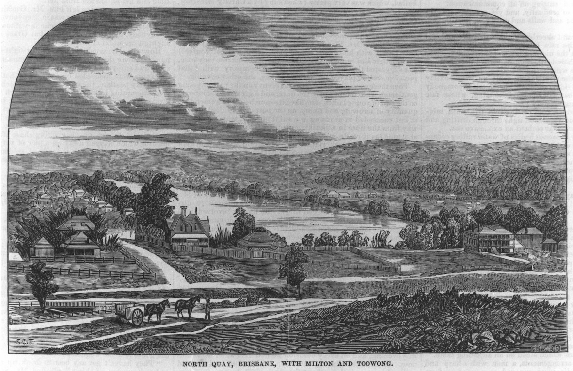
North Quay, Brisbane with Milton and Toowong, ca.1866. Engraving by F.C. Torry. Digital copy print, negative no. 143604. John Oxley Library, State Library of Queensland.
Oxley then continues, describing the varying depths and make up of the sea floor in Moreton Bay and where might make good anchorage for different sized ships. He then puts forward his recommendation for a settlement:
Should it be deemed expedient to establish a Settlement in Moreton Bay, the Country in the vicinity of Red Cliff Point offers the best Site for an Establishment in the first instance; it is centrical in the Bay, and there is no difficulty in effecting a landing at all times of Tide, though the Soil immediately on the Sea Shore is but indifferent. A communication can easily be opened with the Interior; it is about 10 miles to the north of the Entrance into Brisbane River, and must be passed by all Vessels intending to enter it. Red Cliff Point must, however, be viewed as being better adapted for a Military Post and Depot for Stores than as the Site of a Principal Settlement; the Brisbane River presents so many superior situations that, although a Post here may be indispensable, I think a permanent Settlement would be most advantageously formed on the West Side of the River at the termination of Sea Reach [near the mouth of Breakfast Creek].
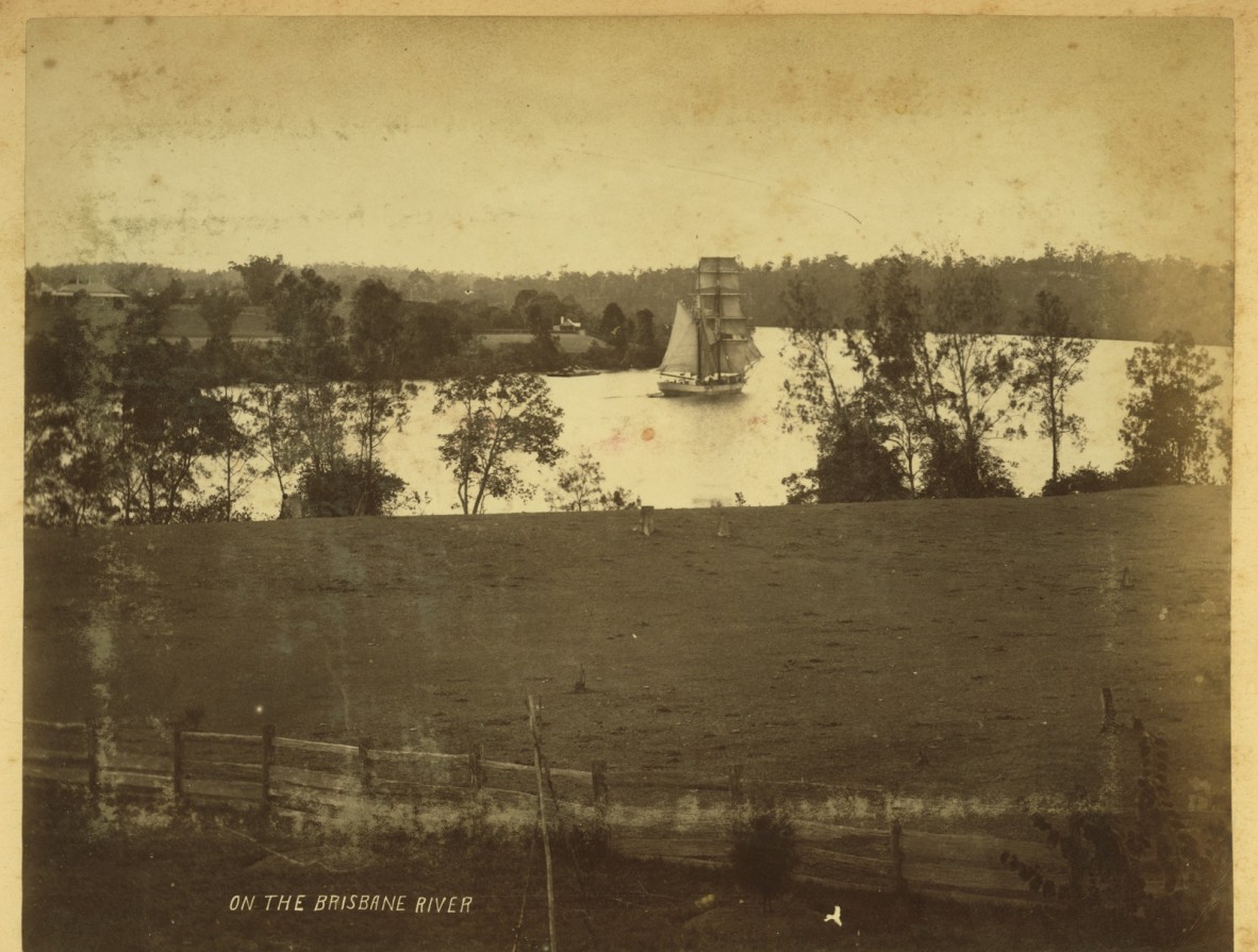
Sailing vessel on New Farm Reach, Brisbane River, c.1860s. Photographer unknown. Image no. APO-026-0001-0003 from APO-26 Views of Queensland photograph album ca.1859-ca.1910. John Oxley Library, State Library of Queensland.
The River here is not fresh, but there is plenty of fresh water. The Country is open, and no obstacles exist from Swamps of hills to prevent a ready Communication with the Interior either by the River itself or at a distance from it… The ground is dry, the Soil good, and it received the full force of the Sea breeze.
![Landing of Oxley [work of art], 1851.](/sites/default/files/styles/slq_standard/public/Landing%20of%20Oxley%203.jpg?itok=Qutasn6D)
Landing of Oxley [work of art], 1851. A.G. Stark. Accession 30480 A.G. Stark Landing of Oxley [Work of Art]. John Oxley Library, State Library of Queensland.
Oxley goes on to describe his observations regarding the local Aboriginal people of the area:
The Natives, in the intercourse we had with them, appeared to possess a most friendly disposition. They are very numerous… For a more detailed description of these people, I beg to refer you to my Journal.
It should be noted here that scholars of Oxley have interpolated this as referring to Mr Uniacke’s account of his interactions with Aboriginal people whilst John Oxley was exploring the river. John Uniacke was Superintendent of Distilleries in New South Wales. While his role in accompanying Oxley on this voyage was to identify and collect rocks and minerals, he also had expertise in rare birds and flora and fauna in general. Uniacke stayed at Pumicestone Channel, close to Redcliffe, while Oxley and his party explored the river. He took a great interest in the Aboriginal people of the area and described his observations at length in his Narrative of Mr Oxley’s Expedition.
Here ends our blog series commemorating the 200th anniversary of John Oxley first entering Maiwar, the Brisbane River, in which we follow his journey upstream and down, day by day.
Further blog articles commemorating Oxley’s second and third journeys to the river, which marks the bicentenary of the establishment of ‘Brisbane’, will be published throughout 2024.
Further resources:
Accession 33036 John Oxley papers. John Oxley Library, State Library of Queensland.
Report of an expedition to survey Port Curtis, Moreton Bay and Port Bowen: with a view to form convict penal settlements there, 1825. John Oxley. Call no. RBJ 994.3 OXL. John Oxley Library, State Library of Queensland.
Plan of the river Brisbane by John Oxley, Surveyor General of New South Wales, created 6 Feb. 1825. John Oxley; John Walker sculpt. Call no. RBM 841.15 1825 00265 E. John Oxley Library, State Library of Queensland.
The Explorers of the Moreton Bay District 1770 – 1830, 1972. J.G. Steele. Published by University of Queensland Press. Call no.Q919.432042 STE C2. John Oxley Library, State Library of Queensland.
Field Book: Exploration of Brisbane River, 30 November 1823 – 5 December 1823. John Oxley (surveyor). Item ID: ITM291077. Queensland State Archives.
Comments
Your email address will not be published.
We welcome relevant, respectful comments.