- Home
- Maps
/
Maps
See how you can use maps to help with your house history research. Find the exact block of land in context of the history of the estates, subdivisions and surrounding areas. Land has its own story. What led to your home being constructed on this block of land? Was it chosen from an estate plan for the promise of a better life?
Video guide
Part 2: Maps
Set the foundations for house history research success by watching State Library’s series of 5 House Histories video guides. Watch below to find out more about maps.
Webinar
Maps: your land in context
Discover essential mapping and land resources to help you on your house history journey.
Estate maps
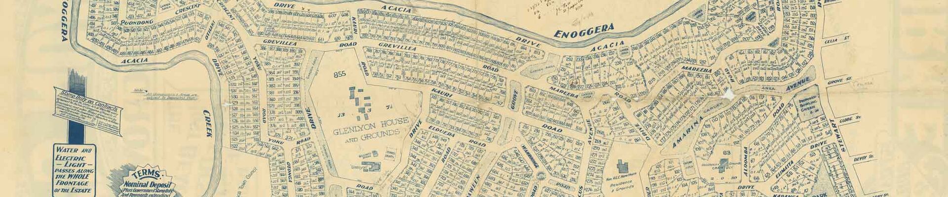
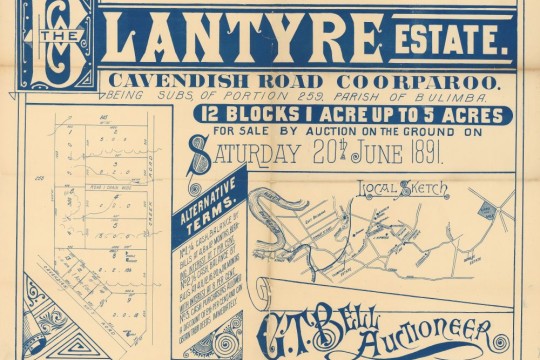
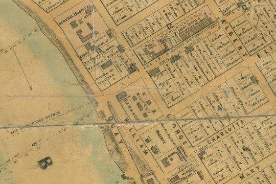
State Library of Queensland has a unique collection of original maps and plans created by real estate firms between the 1850s to the mid 1900s. As well as looking good, these maps can give information about how the land was subdivided, when it was first auctioned, who the surveyors were and who sold the land. They can be useful for investigating the history of urban land areas. The maps are predominantly from Brisbane but also cover some regional areas of Queensland such as the Gold and Sunshine Coasts.
You can find physical estate maps at State Library in the John Oxley Library on level 4 in red folders organised by suburb. Alternatively, explore a sample of our digital collection below.

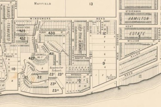
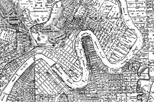
Brisbane maps
Access historical Brisbane maps in the John Oxley Library on level 4 of State Library. Also explore some of our digitised maps below, covering the Brisbane area.
Brisbane City Council Archives
Brisbane City Archives at Moorooka is open to the public during designated opening hours, or by appointment. Brisbane City Council (BCC) holds important records, some of which are online, such as:
- Guide to researching your house history
- Landowners 1900 for Brisbane City and Suburbs
- Detail Plans - use map indexes to find the detail plan number and then check Brisbane City Archives Detail Plans online: sewerage/water maps Brisbane suburbs 1911-1973
- Original Surveyor's field books 1911–1973 provide more information than the detail plans but require a visit to Brisbane City Archives (mainly cover inner, older suburbs). There is a cost.
In the John Oxley Library on level 4 at State Library we have Brisbane City Council Water and Sewerage Maps 1917 in a bound volume in the Open Access collection.
Other resources


State Library resources
Maps: CD-ROMs, Family history desk, level 3
- Greater Brisbane area: alphabetical index of changed street names: C1940s.
- Greater Brisbane area: atlases and street directories: set of 4 1931-c1948.
- Brisbane Directory 1919 (Yates & Jones)
- Refidex/street directories of Brisbane: in the John Oxley Library, level 4. (Note: use One Search, words "street directories" and limit to 'State Library collections').