Beautiful and strange map depicts Queensland and South Sea islands in 1800s
By JOL Admin | 8 October 2013
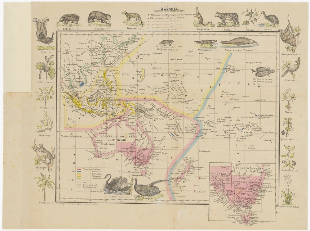
Beautiful and strange describes a newly digitised historical map available at State Library. The French map Oceanie features Queens-land and Micronesie Ocean Pacifique in 1869. Exquisite details are provided about the islands of Micronesia in the late 1800s. The map also features border illustrations of French views of the Kangourou, the Koala and the Lyre as imagined at the time.
Making the map available online is part of a larger State Library 2013 digitisation project to commemorate Australian South Sea Islanders who were brought to Queensland as indentured labourers beginning in the 1860s.
Utilise the JPEG2000 pan and search feature in State Library’s catalogue One Search to look at close-ups of the islands. Enjoy the look of the kakatoes, the Cygne noire and the Ornithorinque. Flora and fauna are also depicted. The Bruxelles Callewaert Freres map is believed to have originally been a plate from a larger atlas of carteographic maps. The map includes an inset map of Southeastern Australia and provides a colour-coded index of island colonisation at the time.
Comments
Your email address will not be published.
We welcome relevant, respectful comments.