Opening up the Kedron Avenues: an interwar development
By Stephanie Ryan, Research Librarian, Information and Client Services | 12 August 2021
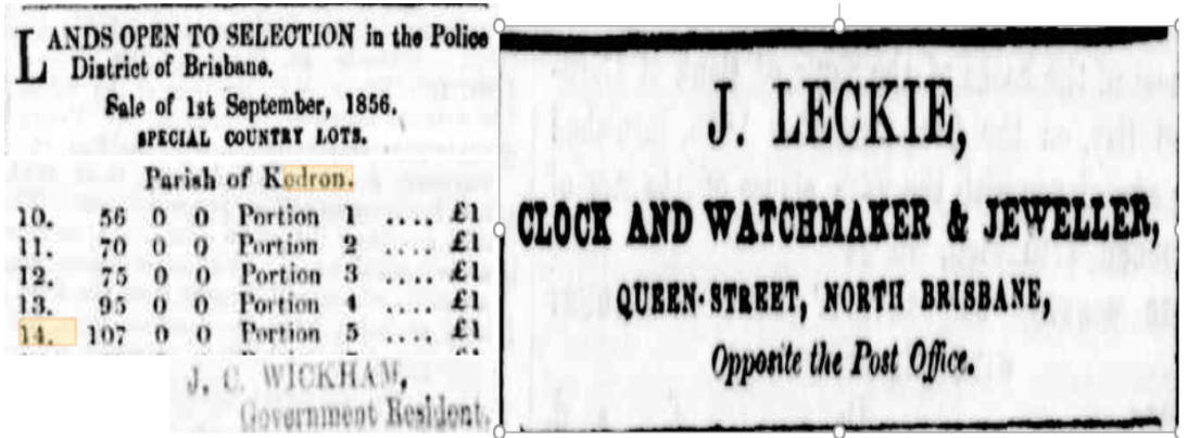
In March 1857 John Leckie, an immigrant Scotsman, purchased 107 acres of land, at £1/acre. Bounded by Edinburgh Castle Road at one end and Kedron Brook at the other, the wide boundary road linking the two came to be named Leckie Road. On the same page that his land purchase was listed in the Moreton Bay Courier, an advertisement for his business in Queen Street also appeared. Leckie, a land speculator, purchased significant other property as well.
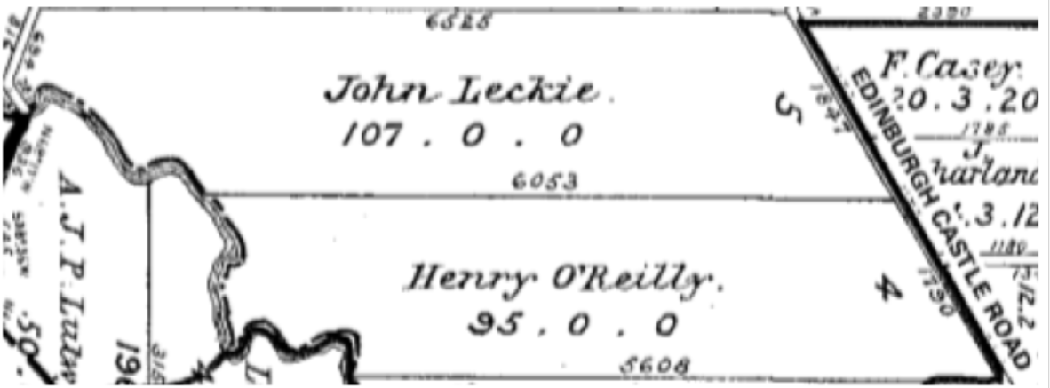
Map of original home buyers Kedron sourced in History of Kedron, D R Teague
Glenkedron (Glen Kedron Estate)
Occasionally Leckie advertised the Kedron land for dairying but little changed until auctioneer, Francis Isles, from the firm Isles & Love, purchased 90 acres in 1899. By 17 November 1917, during the First World War, the first section of 246 sites of Glenkedron (Glen Kedron) Estate went on sale as residential blocks. The estate name came from the Love property on Kedron Brook. The name Kedron was earlier given to the brook by German missionaries, the first free settlers who arrived in Nundah in 1837. A special tram to the Kedron terminus at Kedron Brook was provided. Few would have had alternative means of travel.
Given the war, sales were slow. The second section was on sale 22 June 1918, and, acknowledging the war, special concessions were offered to soldiers and those who would enlist within three months. On 17 April 1920, the third section of Glenkedron went on sale.
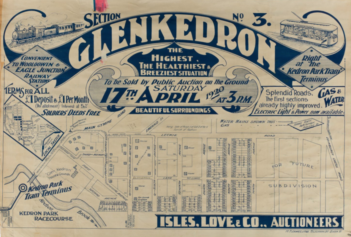
Glenkedron Section No 3, State Library of Queensland
The advertisements and real estate maps (often referred to as lithographs) tell us about what was valued at the time, which is often taken for granted today. Proximity to train and tram mattered as the only means of transport. Gas and water were relatively new. The desirable claim ‘The highest, the healthiest and breeziest situation’ was contested by other estates. In this map of the third section of Glenkedron estate, we see not only what land is on sale and its context in the local area, but also an indication of where home building had already occurred.
Glenkedron South Estate
On 7 August 1920, the first section of Glenkedron South opened with promotional flare. The Daily Mail advertised ‘intrepid airman,’ Lieutenant Roberts’, ‘thrilling exhibition over the estate at 2.45 pm sharp’ on the day. The land, part of Barron’s Estate, was advertised as ‘that glorious succession of rolling green-sward ridges’. On 18 September 1920, the sale continued with Glenkedron South: Section 2.
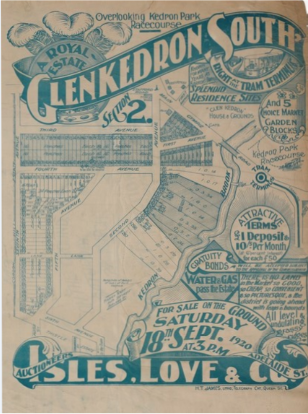
Glenkedron South Section 3, State Library of Queensland
On 30 October 1920, the third section of Glenkedron South, this ‘royal estate’, was available for sale. The real estate map showed current housing development and available land. A fourth section was on sale 29 January 1921, stating ‘There is no land in the market so good, so cheap, so convenient’.
Glenkedron House and grounds
On 19 March 1921, Glenkedron House and grounds were marketed together with a ‘clearing sale’ of sections 1-3.
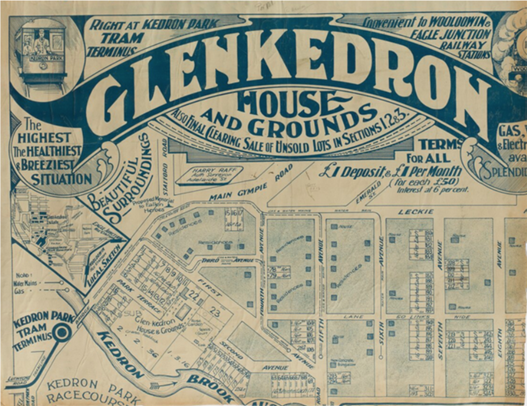
Glenkedron House and Grounds, State Library of Queensland
The Glenkedron House and grounds real estate map showed houses built and blocks still available. The many repeated Brisbane Courier advertisements, the most recent being 18 March 1921, the day before the sale, named those blocks. Glenkedron House of 11 rooms, dancing veranda, garage and beautiful extensive grounds was accessible by ‘card only’.
Sales of Glenkedron (increasingly Glen Kedron) Estate reflected this difficult economic period. T. M. (Thomas Michael) Burke bought the remaining land in 1923, marketing it state-wide at greater prices, further slowing property sales. The 1924 map of Glenkedron South: the unsold balance showed what remained. In 1938, the names of First to Fourth Avenues changed to streets: Lasseter, Haines, Erskine (Avenue) and Arnott. State Library holds the T M Burke real estate records viewable onsite. By 1950, much of the Kedron Avenues had been sold and developed.
Community connections in the Avenues
Community connections within the Avenues included the Methodist Church, now heritage-listed but now used as a childcare centre, opened in February 1926 on the corner of Ninth Avenue and Leckie Road.
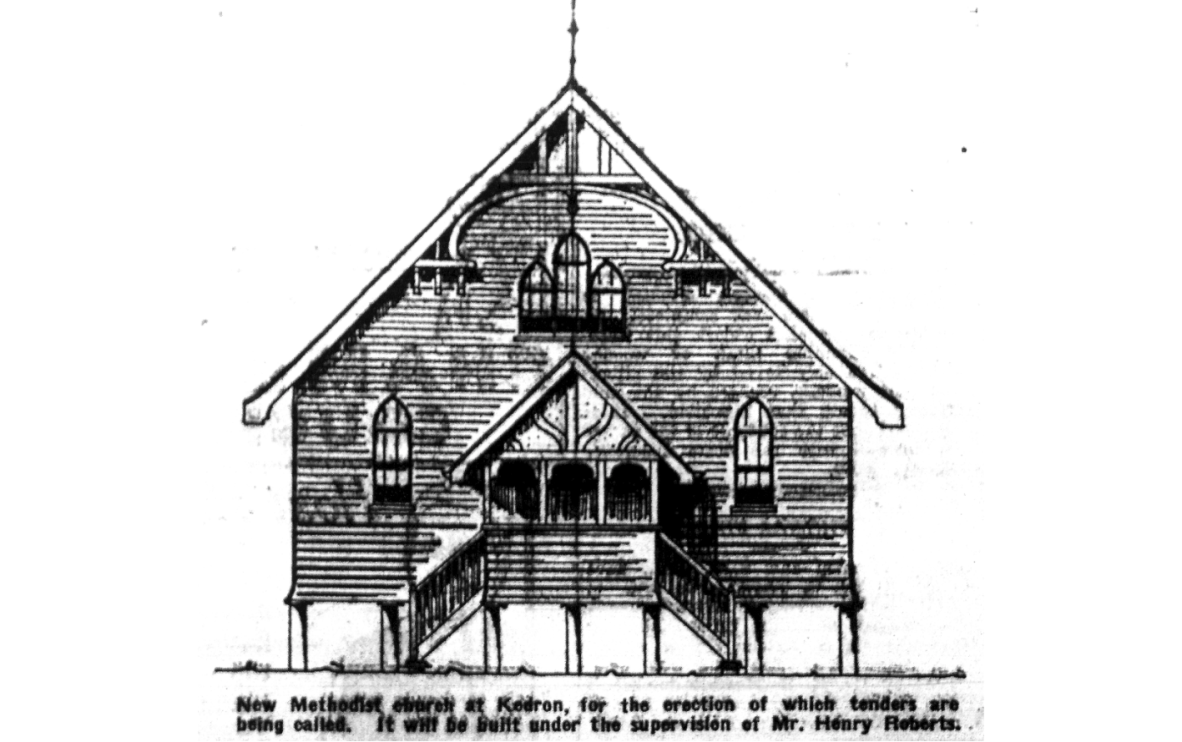
The building contractor, Henry Roberts of Malayta Fifth Avenue, was involved in local building and real estate activity. The Anglican Church (now the Brisbane Cantonese Christian Church) on the Glen Kedron Lane and Tenth Avenue corner, opened on 4 March 1928, on land James Love of Glenkedron donated. Apart from the churches, there was a substantial convenience store (now a Vet Clinic) on the corner of Eighth Avenue and Leckie Road, designed by interwar architect, Eric Trewern, who called for tenders 21 June 1927 to build it. In the days before supermarkets and private transport, it provided an essential destination and common meeting point. A butcher shop (now supporting care needs), between the Methodist Church and the shop in Leckie Road, provided a service hub in the Avenues.
Photographs and homes
The houses in the Avenues reflected the interwar styles which can be checked in Judy Rechner’s Brisbane house styles 1880 to 1940: a guide to the affordable house although designs changed with the advent of units, split blocks and housing renovation. A taste of that difference can be found in the Corley photographs. Frank and Eunice Corley took photos of homes in south-east Queensland in the late 1960s-early 1970s and framed them in calendars or greeting cards for sale. Those they didn’t sell they kept to avoid sales tax. These have been digitised and are available online through One Search. Select ‘digitised collections’ and search by keywords ‘Corley’ and ‘Kedron’ to check for your home.
Real estate maps (lithographs) and newspapers
These maps, sometimes works of art, together with newspaper advertisements, were major promotional devices. They showed an area’s development when the jigsaw puzzle of estates is put together. What people valued in property and transport surprises us today. They explain the context of the local neighbourhood and, to some extent, how people lived and so provide us with a framework for personal, family and local history.
More information
References
Reference 1
Reference 2
Comments
Your email address will not be published.
We welcome relevant, respectful comments.