This real estate map from 1917 advertises land for sale at the Greenwood Estate, now part of the Brisbane suburb of Ashgrove. The allotments were situated along Quandong Street, Greenwood Street and 3 Mile Scrub Road (now Ashgrove Avenue).
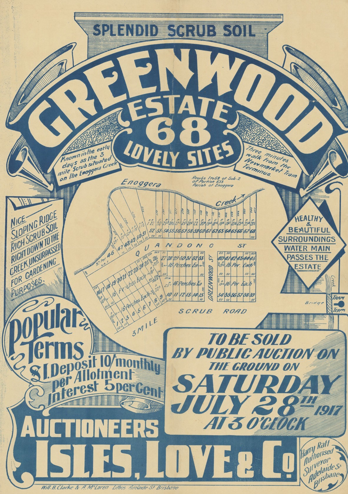
Greenwood Estate, , 1917. John Oxley Library, State Library of Queensland
Extensive publicity for the Greenwood Estate was published in Brisbane newspapers prior to the auction date, which was set for 28 July 1917.
"Known in the early days as the 3-mile Scrub, situated on Enoggera Creek, about three minutes' walk from the Newmarket Tram Terminus. A nice sloping ridge with rich scrub soil right down to the creek. Just the place to build a home - where you can get a good garden about you in no time...It was always the pretty picnic spot of Brisbane, and many an expedition was made by young Brisbaneites 35 years ago in search of Quandongs and Figs." (The Telegraph, 14 July 1917).
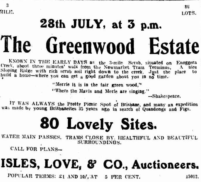
Advertisement for the Greenwood Estate published in The Telegragh 14 July 1917, p.11
A week before the sale, auctioneers Isles, Love, & Co. announced the auction would be delayed "owning to the extraordinary demands made by the local authority in connection with the subdivision of the Estate". Newspaper articles outlining the dispute between the auctioneers and Ithaca Council can be found on Trove newspapers.
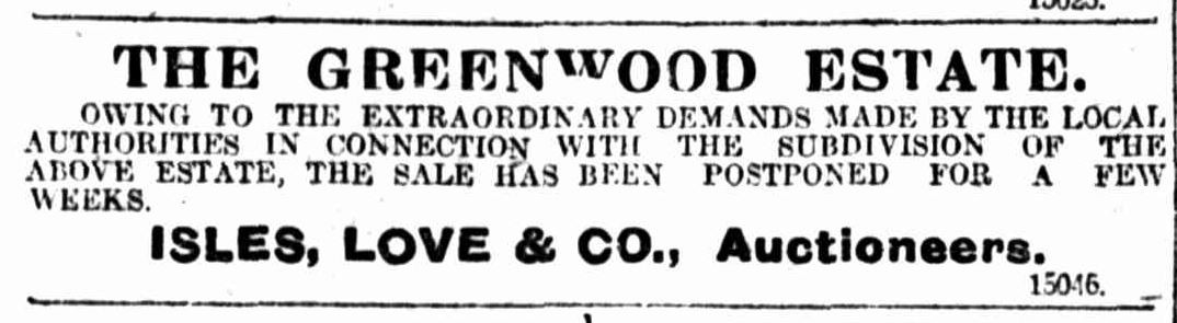
Announcement regarding the delay of the sale for the Greenwood Estate. Published in The Daily Mail, 21 July 1917, p.12
The Greenwood Estate was eventually offered for sale a few months later on 8 September.
"Messrs Isles, Love, and Co. report a successful sale of the ground, on Saturday afternoon last, when all of the allotments, numbering 67, were disposed of for a total of £1,949, at prices ranging up to £59 each." (The Telegraph, 10 September 1917, p.9).
A higher resolution image of this map can be viewed and downloaded through our One Search catalogue.
Prints of this map are also available through the Library Shop.You can browse a compendium of our previous maps of the week on our blog.
Browse our collection of digitised real estate maps on Historypin.
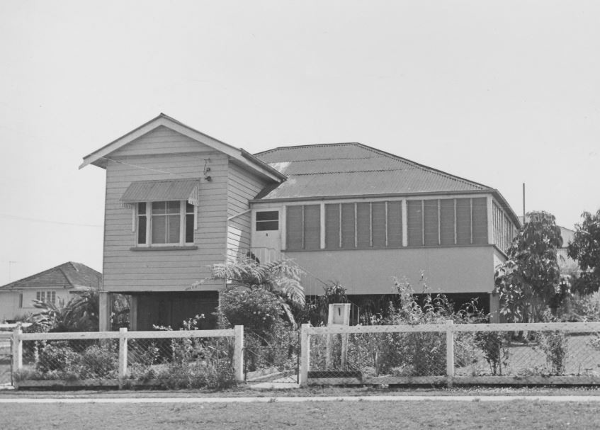
Find your Ashgrove house in the Frank and Eunice Corley collection
6 Ashgrove Crescent, Ashgrove. From 6169 Frank and Eunice Corley House Photographs. John Oxley Library, State Library of Queensland. Image 6169-1635-0001
From the 1960s to the 1970s, Frank and Eunice Corley drove the suburban streets of Queensland in their pink Cadillac, taking photographs of houses and selling them to homeowners. A database containing over 61,000 photographs can now be searched and viewed online. There are 285 photographs for the suburb of Ashgrove.
Myles Sinnamon – Engagement Officer, State Library of QueenslandComments
Your email address will not be published.
We welcome relevant, respectful comments.