Digitised @ SLQ : Geological map of the Moreton district
By JOL Admin | 13 March 2015
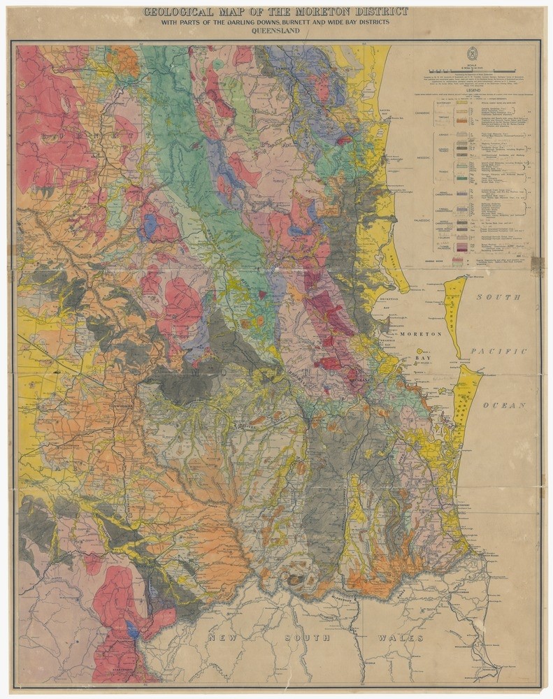
Geological map of the Moreton district with parts of the Darling Downs, Burnett and Wide Bay districts
What did your part of Queensland look like over the past 150 years? Enjoy Geological Survey maps in the State Library’s collection. Featured is a newly digitised geological map of the Moreton district from 1955 created by renowned Dorothy Hill.
Born in Brisbane in 1907, Dr. Hill attended Brisbane Girls Grammar School. She then won an entrance scholarship to University of Queensland and went on to Cambridge University. She returned to Australia in 1932 and was widely published in palaeontology, stratigraphy and geology. Her work about Australian corals set a world-wide standard. She later became first female president of the University of Queensland. State Library holds many of her published works as well as access to online articles by and about her.
Other geologists for Queensland included Christopher D'Oyly Hale Aplin, hired by Queensland Government on 1 April 1868 for the Southern Region, and Richard Daintree, hired on 12 May 1868 for the Northern Region. In 1875 Augustus Charles Gregory was appointed for the southern part of Queensland, and Robert Logan Jack started in 1877 in Townsville. Early focus was on gold and coal.
Digitised maps at State Library have a pan and search feature. Click on the link to View the Digitised Version. Once open in the viewer, click on view options and then on a small icon labelled JP2. This feature allows panning and zooming in for rich detail.
Comments
Your email address will not be published.
We welcome relevant, respectful comments.